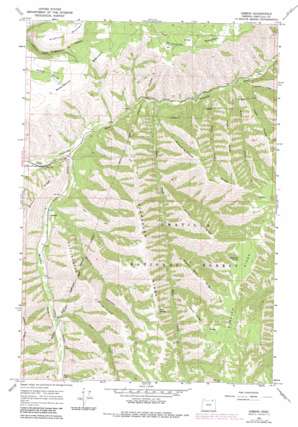
Gibbon Topo Map Oregon
To zoom in, hover over the map of Gibbon
USGS Topo Quad 45118f3 - 1:24,000 scale
| Topo Map Name: | Gibbon |
| USGS Topo Quad ID: | 45118f3 |
| Print Size: | ca. 21 1/4" wide x 27" high |
| Southeast Coordinates: | 45.625° N latitude / 118.25° W longitude |
| Map Center Coordinates: | 45.6875° N latitude / 118.3125° W longitude |
| U.S. State: | OR |
| Filename: | o45118f3.jpg |
| Download Map JPG Image: | Gibbon topo map 1:24,000 scale |
| Map Type: | Topographic |
| Topo Series: | 7.5´ |
| Map Scale: | 1:24,000 |
| Source of Map Images: | United States Geological Survey (USGS) |
| Alternate Map Versions: |
Gibbon OR 1964, updated 1966 Download PDF Buy paper map Gibbon OR 1964, updated 1983 Download PDF Buy paper map Gibbon OR 1995, updated 1998 Download PDF Buy paper map Gibbon OR 2011 Download PDF Buy paper map Gibbon OR 2014 Download PDF Buy paper map |
| FStopo: | US Forest Service topo Gibbon is available: Download FStopo PDF Download FStopo TIF |
1:24,000 Topo Quads surrounding Gibbon
> Back to 45118e1 at 1:100,000 scale
> Back to 45118a1 at 1:250,000 scale
> Back to U.S. Topo Maps home
Gibbon topo map: Gazetteer
Gibbon: Populated Places
Gibbon elevation 534m 1751′Gibbon: Post Offices
Gibbon Post Office (historical) elevation 534m 1751′Gibbon: Ridges
Forks Ridge elevation 1193m 3914′Gibbon Ridge elevation 865m 2837′
Hagar Ridge elevation 1036m 3398′
Hagen Ridge elevation 1127m 3697′
Plenty Bear Ridge elevation 1318m 4324′
Rattlesnake Ridge elevation 1086m 3562′
Short Ridge elevation 1342m 4402′
Starve-to-Death Ridge elevation 1213m 3979′
Stumbough Ridge elevation 1217m 3992′
Gibbon: Springs
Rock Spring elevation 1235m 4051′Thompson Spring elevation 1404m 4606′
Gibbon: Streams
Bobsled Creek elevation 628m 2060′Hagar Creek elevation 617m 2024′
Hagen Creek elevation 609m 1998′
Line Creek elevation 598m 1961′
Meacham Creek elevation 537m 1761′
Ryan Creek elevation 587m 1925′
Gibbon: Summits
Reservation Mountain elevation 990m 3248′Gibbon: Valleys
Boston Canyon elevation 558m 1830′Gibbon digital topo map on disk
Buy this Gibbon topo map showing relief, roads, GPS coordinates and other geographical features, as a high-resolution digital map file on DVD:


