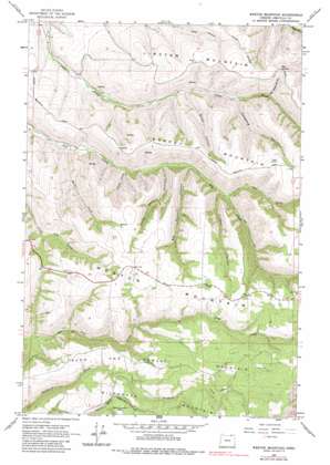
Weston Mountain Topo Map Oregon
To zoom in, hover over the map of Weston Mountain
USGS Topo Quad 45118g3 - 1:24,000 scale
| Topo Map Name: | Weston Mountain |
| USGS Topo Quad ID: | 45118g3 |
| Print Size: | ca. 21 1/4" wide x 27" high |
| Southeast Coordinates: | 45.75° N latitude / 118.25° W longitude |
| Map Center Coordinates: | 45.8125° N latitude / 118.3125° W longitude |
| U.S. State: | OR |
| Filename: | o45118g3.jpg |
| Download Map JPG Image: | Weston Mountain topo map 1:24,000 scale |
| Map Type: | Topographic |
| Topo Series: | 7.5´ |
| Map Scale: | 1:24,000 |
| Source of Map Images: | United States Geological Survey (USGS) |
| Alternate Map Versions: |
Weston Mountain OR 1964, updated 1965 Download PDF Buy paper map Weston Mountain OR 1964, updated 1983 Download PDF Buy paper map Weston Mountain OR 2011 Download PDF Buy paper map Weston Mountain OR 2014 Download PDF Buy paper map |
1:24,000 Topo Quads surrounding Weston Mountain
> Back to 45118e1 at 1:100,000 scale
> Back to 45118a1 at 1:250,000 scale
> Back to U.S. Topo Maps home
Weston Mountain topo map: Gazetteer
Weston Mountain: Gaps
Big Saddle elevation 858m 2814′Weston Mountain: Post Offices
Briggson Post Office (historical) elevation 966m 3169′Tamarack Post Office (historical) elevation 1102m 3615′
Weston Mountain: Streams
Heifer Creek elevation 542m 1778′Pole Creek elevation 710m 2329′
Weston Mountain: Summits
Basket Mountain elevation 896m 2939′Lincton Mountain elevation 897m 2942′
Reed and Hawley Mountain elevation 1143m 3750′
Weston Mountain elevation 1032m 3385′
Wildhorse Mountain elevation 1040m 3412′
Weston Mountain: Valleys
Big Rayborn Canyon elevation 659m 2162′Big Saddle Canyon elevation 683m 2240′
Coyote Canyon elevation 602m 1975′
Hodgson Canyon elevation 701m 2299′
Keseberg Canyon elevation 653m 2142′
Little Rayborn Canyon elevation 633m 2076′
Scott Canyon elevation 601m 1971′
Weston Mountain digital topo map on disk
Buy this Weston Mountain topo map showing relief, roads, GPS coordinates and other geographical features, as a high-resolution digital map file on DVD:


