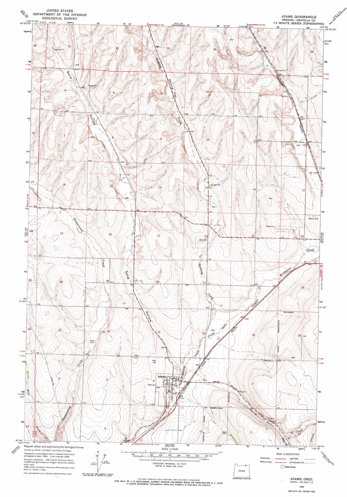
Adams Topo Map Oregon
To zoom in, hover over the map of Adams
USGS Topo Quad 45118g5 - 1:24,000 scale
| Topo Map Name: | Adams |
| USGS Topo Quad ID: | 45118g5 |
| Print Size: | ca. 21 1/4" wide x 27" high |
| Southeast Coordinates: | 45.75° N latitude / 118.5° W longitude |
| Map Center Coordinates: | 45.8125° N latitude / 118.5625° W longitude |
| U.S. State: | OR |
| Filename: | o45118g5.jpg |
| Download Map JPG Image: | Adams topo map 1:24,000 scale |
| Map Type: | Topographic |
| Topo Series: | 7.5´ |
| Map Scale: | 1:24,000 |
| Source of Map Images: | United States Geological Survey (USGS) |
| Alternate Map Versions: |
Adams OR 1966, updated 1967 Download PDF Buy paper map Adams OR 2011 Download PDF Buy paper map Adams OR 2014 Download PDF Buy paper map |
1:24,000 Topo Quads surrounding Adams
Zangar Junction |
Touchet |
Lowden |
College Place |
Walla Walla |
Ring |
Smeltz |
Waterman |
Milton-Freewater |
Bowlus Hill |
Holdman Se |
Helix |
Adams |
Athena |
Weston Mountain |
Pendleton |
Mission |
Cayuse |
Thorn Hollow |
Gibbon |
Mckay Reservoir |
Table Rock |
Cabbage Hill |
Meacham |
Duncan |
> Back to 45118e1 at 1:100,000 scale
> Back to 45118a1 at 1:250,000 scale
> Back to U.S. Topo Maps home
Adams topo map: Gazetteer
Adams: Airports
Barrett Field elevation 546m 1791′Davis Airstrip elevation 477m 1564′
Adams: Flats
Gerking Flat elevation 565m 1853′Adams: Parks
Adams City Park elevation 461m 1512′Adams: Populated Places
Adams elevation 462m 1515′Adams: Post Offices
Adams Post Office elevation 462m 1515′Adams: Streams
Gerking Creek elevation 476m 1561′Spring Hollow Creek elevation 467m 1532′
West Fork Spring Hollow Creek elevation 515m 1689′
Adams: Valleys
Sand Hollow elevation 464m 1522′Waterman Gulch elevation 564m 1850′
Adams digital topo map on disk
Buy this Adams topo map showing relief, roads, GPS coordinates and other geographical features, as a high-resolution digital map file on DVD: