Freezeout Ridge Topo Map Oregon
To zoom in, hover over the map of Freezeout Ridge
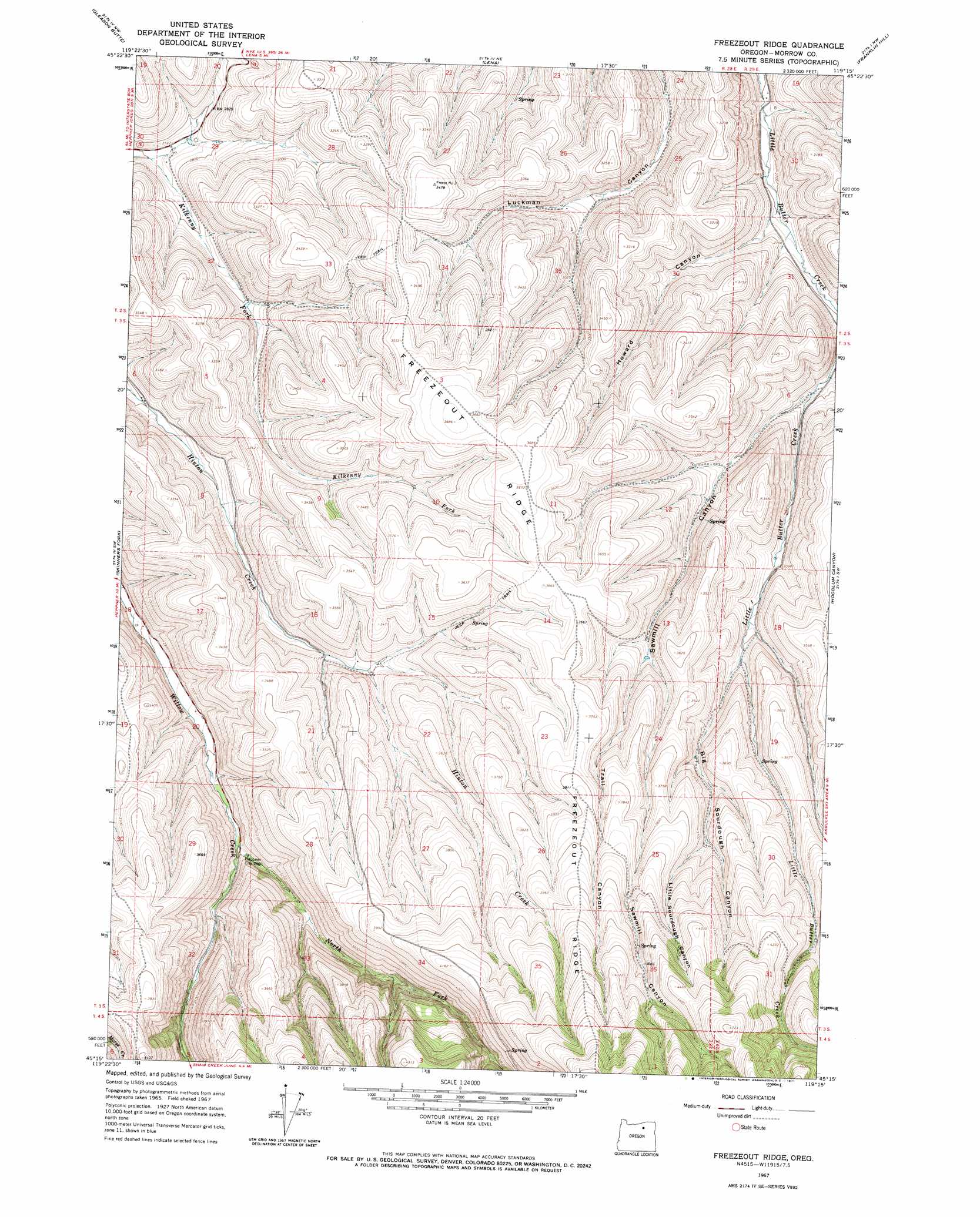
USGS Topo Quad 45119c3 - 1:24,000 scale
| Topo Map Name: | Freezeout Ridge |
| USGS Topo Quad ID: | 45119c3 |
| Print Size: | ca. 21 1/4" wide x 27" high |
| Southeast Coordinates: | 45.25° N latitude / 119.25° W longitude |
| Map Center Coordinates: | 45.3125° N latitude / 119.3125° W longitude |
| U.S. State: | OR |
| Filename: | o45119c3.jpg |
| Download Map JPG Image: | Freezeout Ridge topo map 1:24,000 scale |
| Map Type: | Topographic |
| Topo Series: | 7.5´ |
| Map Scale: | 1:24,000 |
| Source of Map Images: | United States Geological Survey (USGS) |
| Alternate Map Versions: |
Freezeout Ridge OR 1967, updated 1971 Download PDF Buy paper map Freezeout Ridge OR 2011 Download PDF Buy paper map Freezeout Ridge OR 2014 Download PDF Buy paper map |
1:24,000 Topo Quads surrounding Freezeout Ridge
Strawberry Canyon Se |
Butter Creek Junction |
Vey Ranch |
Echo Sw |
Echo Se |
Swaggart Buttes |
Gleason Butte |
Lena |
Franklin Hill |
Vinson |
Heppner |
Skinners Fork |
Freezeout Ridge |
Hoodlum Canyon |
Gurdane |
Balm Canyon |
Summerfield Ridge |
Arbuckle Mountain |
Matlock Prairie |
Sugarbowl Creek |
Big Rock Flat |
Madison Butte |
Lake Penland |
Thompson Flat |
Deerhorn Creek |
> Back to 45119a1 at 1:100,000 scale
> Back to 45118a1 at 1:250,000 scale
> Back to U.S. Topo Maps home
Freezeout Ridge topo map: Gazetteer
Freezeout Ridge: Streams
North Fork Willow Creek elevation 911m 2988′Freezeout Ridge: Valleys
Big Sourdough Canyon elevation 989m 3244′Howard Canyon elevation 824m 2703′
Little Sourdough Canyon elevation 1097m 3599′
Sawmill Canyon elevation 874m 2867′
Trail Canyon elevation 1016m 3333′
Freezeout Ridge: Wells
Heppner City Well elevation 920m 3018′Freezeout Ridge digital topo map on disk
Buy this Freezeout Ridge topo map showing relief, roads, GPS coordinates and other geographical features, as a high-resolution digital map file on DVD: