Swaggart Buttes Topo Map Oregon
To zoom in, hover over the map of Swaggart Buttes
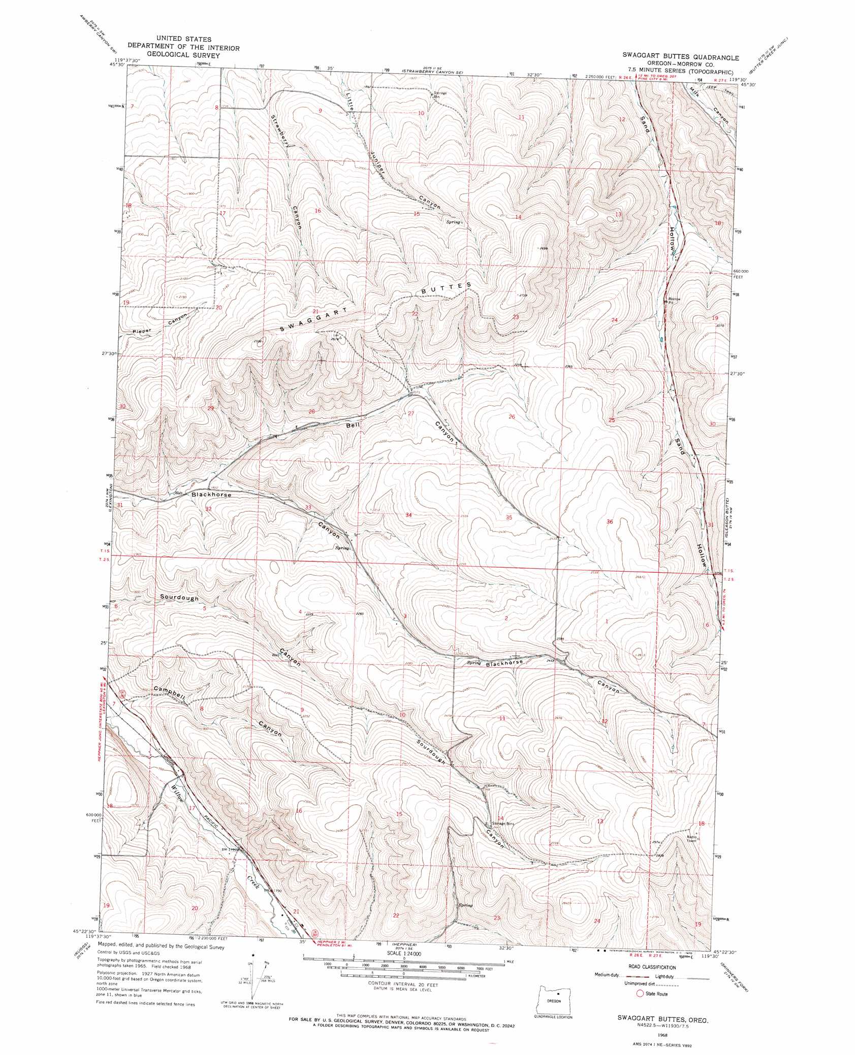
USGS Topo Quad 45119d5 - 1:24,000 scale
| Topo Map Name: | Swaggart Buttes |
| USGS Topo Quad ID: | 45119d5 |
| Print Size: | ca. 21 1/4" wide x 27" high |
| Southeast Coordinates: | 45.375° N latitude / 119.5° W longitude |
| Map Center Coordinates: | 45.4375° N latitude / 119.5625° W longitude |
| U.S. State: | OR |
| Filename: | o45119d5.jpg |
| Download Map JPG Image: | Swaggart Buttes topo map 1:24,000 scale |
| Map Type: | Topographic |
| Topo Series: | 7.5´ |
| Map Scale: | 1:24,000 |
| Source of Map Images: | United States Geological Survey (USGS) |
| Alternate Map Versions: |
Swaggart Buttes OR 1968, updated 1970 Download PDF Buy paper map Swaggart Buttes OR 2011 Download PDF Buy paper map Swaggart Buttes OR 2014 Download PDF Buy paper map |
1:24,000 Topo Quads surrounding Swaggart Buttes
Ella |
Well Spring |
Strawberry Canyon Ne |
Ward Butte |
Service Buttes |
Ione North |
Strawberry Canyon Sw |
Strawberry Canyon Se |
Butter Creek Junction |
Vey Ranch |
Ione South |
Lexington |
Swaggart Buttes |
Gleason Butte |
Lena |
Eightmile |
Ruggs |
Heppner |
Skinners Fork |
Freezeout Ridge |
Buttermilk Canyon |
Hardman |
Balm Canyon |
Summerfield Ridge |
Arbuckle Mountain |
> Back to 45119a1 at 1:100,000 scale
> Back to 45118a1 at 1:250,000 scale
> Back to U.S. Topo Maps home
Swaggart Buttes topo map: Gazetteer
Swaggart Buttes: Reservoirs
Turner Reservoir elevation 551m 1807′Swaggart Buttes: Springs
Munkers Spring elevation 544m 1784′Swaggart Buttes: Summits
Swaggart Buttes elevation 795m 2608′Swaggart Buttes: Valleys
Bell Canyon elevation 553m 1814′Swaggart Buttes digital topo map on disk
Buy this Swaggart Buttes topo map showing relief, roads, GPS coordinates and other geographical features, as a high-resolution digital map file on DVD: