Lexington Topo Map Oregon
To zoom in, hover over the map of Lexington
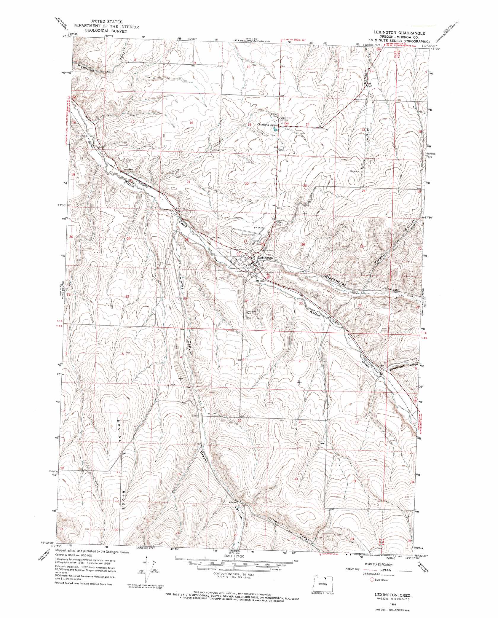
USGS Topo Quad 45119d6 - 1:24,000 scale
| Topo Map Name: | Lexington |
| USGS Topo Quad ID: | 45119d6 |
| Print Size: | ca. 21 1/4" wide x 27" high |
| Southeast Coordinates: | 45.375° N latitude / 119.625° W longitude |
| Map Center Coordinates: | 45.4375° N latitude / 119.6875° W longitude |
| U.S. State: | OR |
| Filename: | o45119d6.jpg |
| Download Map JPG Image: | Lexington topo map 1:24,000 scale |
| Map Type: | Topographic |
| Topo Series: | 7.5´ |
| Map Scale: | 1:24,000 |
| Source of Map Images: | United States Geological Survey (USGS) |
| Alternate Map Versions: |
Lexington OR 1968, updated 1970 Download PDF Buy paper map Lexington OR 2011 Download PDF Buy paper map Lexington OR 2014 Download PDF Buy paper map |
1:24,000 Topo Quads surrounding Lexington
Dalreed Butte |
Ella |
Well Spring |
Strawberry Canyon Ne |
Ward Butte |
Cecil |
Ione North |
Strawberry Canyon Sw |
Strawberry Canyon Se |
Butter Creek Junction |
Utts Butte |
Ione South |
Lexington |
Swaggart Buttes |
Gleason Butte |
Gooseberry |
Eightmile |
Ruggs |
Heppner |
Skinners Fork |
Lone Rock Creek |
Buttermilk Canyon |
Hardman |
Balm Canyon |
Summerfield Ridge |
> Back to 45119a1 at 1:100,000 scale
> Back to 45118a1 at 1:250,000 scale
> Back to U.S. Topo Maps home
Lexington topo map: Gazetteer
Lexington: Airports
Lexington Airport elevation 496m 1627′Lexington: Populated Places
Lexington elevation 442m 1450′Lexington: Post Offices
Lexington Post Office elevation 442m 1450′Lexington: Reservoirs
Cutsforth Reservoir elevation 502m 1646′Lexington: Streams
Sourdough Creek elevation 483m 1584′Lexington: Valleys
Blackhorse Canyon elevation 434m 1423′Campbell Canyon elevation 502m 1646′
Clarks Canyon elevation 415m 1361′
Fuller Canyon elevation 519m 1702′
Piper Canyon elevation 493m 1617′
Sourdough Canyon elevation 480m 1574′
Lexington digital topo map on disk
Buy this Lexington topo map showing relief, roads, GPS coordinates and other geographical features, as a high-resolution digital map file on DVD: