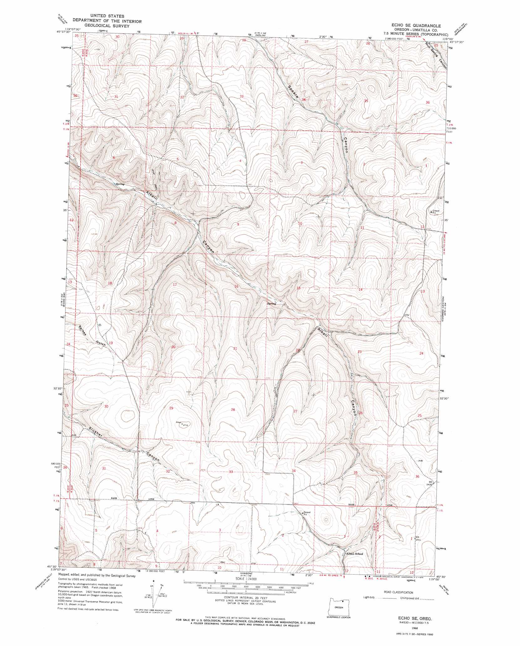
Echo Se Topo Map Oregon
To zoom in, hover over the map of Echo Se
USGS Topo Quad 45119e1 - 1:24,000 scale
| Topo Map Name: | Echo Se |
| USGS Topo Quad ID: | 45119e1 |
| Print Size: | ca. 21 1/4" wide x 27" high |
| Southeast Coordinates: | 45.5° N latitude / 119° W longitude |
| Map Center Coordinates: | 45.5625° N latitude / 119.0625° W longitude |
| U.S. State: | OR |
| Filename: | o45119e1.jpg |
| Download Map JPG Image: | Echo Se topo map 1:24,000 scale |
| Map Type: | Topographic |
| Topo Series: | 7.5´ |
| Map Scale: | 1:24,000 |
| Source of Map Images: | United States Geological Survey (USGS) |
| Alternate Map Versions: |
Echo SE OR 1968, updated 1970 Download PDF Buy paper map Echo SE OR 1968, updated 1991 Download PDF Buy paper map Echo SE OR 2011 Download PDF Buy paper map Echo SE OR 2014 Download PDF Buy paper map |
1:24,000 Topo Quads surrounding Echo Se
Hermiston |
Stanfield |
Stanfield Se |
Holdman |
Holdman Se |
Service Buttes |
Echo |
Nolin |
Barnhart |
Pendleton |
Vey Ranch |
Echo Sw |
Echo Se |
Coombs Canyon |
Mckay Reservoir |
Lena |
Franklin Hill |
Vinson |
Nye |
Pilot Rock |
Freezeout Ridge |
Hoodlum Canyon |
Gurdane |
Carney Butte |
Granite Meadows |
> Back to 45119e1 at 1:100,000 scale
> Back to 45118a1 at 1:250,000 scale
> Back to U.S. Topo Maps home
No gazetteer data is available for the Echo Se topo map sheet.
Echo Se digital topo map on disk
Buy this Echo Se topo map showing relief, roads, GPS coordinates and other geographical features, as a high-resolution digital map file on DVD: