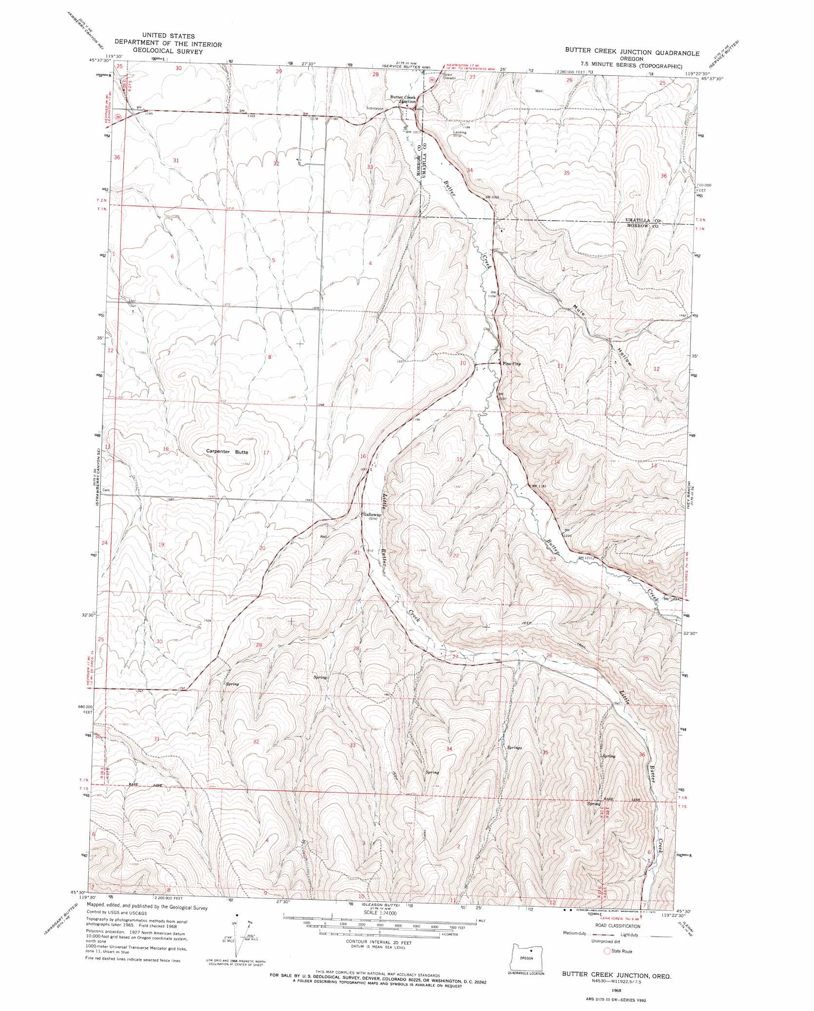
Butter Creek Junction Topo Map Oregon
To zoom in, hover over the map of Butter Creek Junction
USGS Topo Quad 45119e4 - 1:24,000 scale
| Topo Map Name: | Butter Creek Junction |
| USGS Topo Quad ID: | 45119e4 |
| Print Size: | ca. 21 1/4" wide x 27" high |
| Southeast Coordinates: | 45.5° N latitude / 119.375° W longitude |
| Map Center Coordinates: | 45.5625° N latitude / 119.4375° W longitude |
| U.S. State: | OR |
| Filename: | o45119e4.jpg |
| Download Map JPG Image: | Butter Creek Junction topo map 1:24,000 scale |
| Map Type: | Topographic |
| Topo Series: | 7.5´ |
| Map Scale: | 1:24,000 |
| Source of Map Images: | United States Geological Survey (USGS) |
| Alternate Map Versions: |
Butter Creek Junction OR 1968, updated 1970 Download PDF Buy paper map Butter Creek Junction OR 2011 Download PDF Buy paper map Butter Creek Junction OR 2014 Download PDF Buy paper map |
1:24,000 Topo Quads surrounding Butter Creek Junction
Boardman |
Clarke |
Ordnance |
Hermiston |
Stanfield |
Well Spring |
Strawberry Canyon Ne |
Ward Butte |
Service Buttes |
Echo |
Strawberry Canyon Sw |
Strawberry Canyon Se |
Butter Creek Junction |
Vey Ranch |
Echo Sw |
Lexington |
Swaggart Buttes |
Gleason Butte |
Lena |
Franklin Hill |
Ruggs |
Heppner |
Skinners Fork |
Freezeout Ridge |
Hoodlum Canyon |
> Back to 45119e1 at 1:100,000 scale
> Back to 45118a1 at 1:250,000 scale
> Back to U.S. Topo Maps home
Butter Creek Junction topo map: Gazetteer
Butter Creek Junction: Populated Places
Galloway (historical) elevation 399m 1309′Pine City elevation 346m 1135′
Butter Creek Junction: Post Offices
Acton Post Office (historical) elevation 331m 1085′Atwood Post Office (historical) elevation 307m 1007′
Galloway Post Office (historical) elevation 399m 1309′
Butter Creek Junction: Streams
Little Butter Creek elevation 337m 1105′Butter Creek Junction: Summits
Carpenter Butte elevation 471m 1545′Butter Creek Junction: Valleys
Mule Hollow elevation 323m 1059′Butter Creek Junction digital topo map on disk
Buy this Butter Creek Junction topo map showing relief, roads, GPS coordinates and other geographical features, as a high-resolution digital map file on DVD: