Well Spring Topo Map Oregon
To zoom in, hover over the map of Well Spring
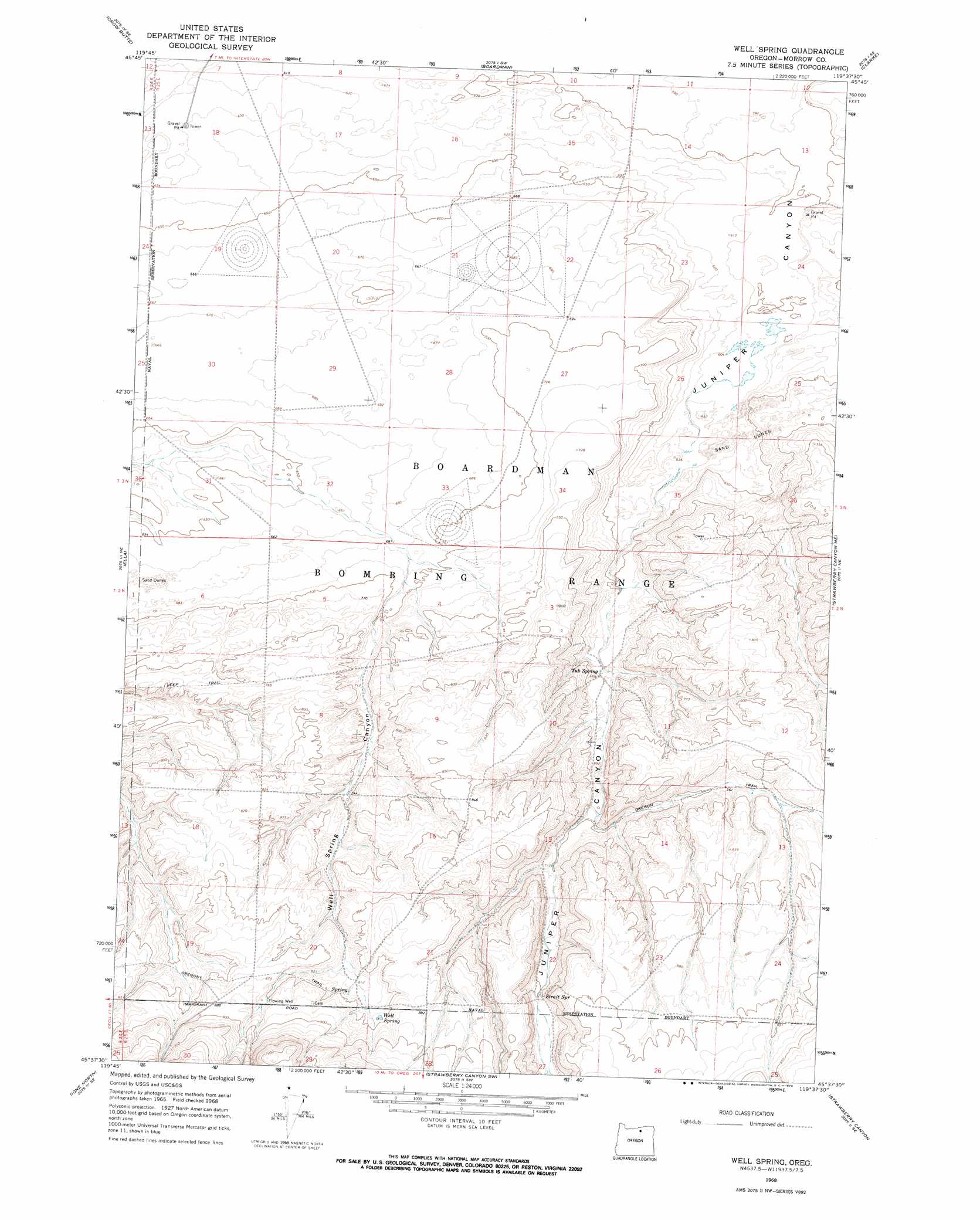
USGS Topo Quad 45119f6 - 1:24,000 scale
| Topo Map Name: | Well Spring |
| USGS Topo Quad ID: | 45119f6 |
| Print Size: | ca. 21 1/4" wide x 27" high |
| Southeast Coordinates: | 45.625° N latitude / 119.625° W longitude |
| Map Center Coordinates: | 45.6875° N latitude / 119.6875° W longitude |
| U.S. State: | OR |
| Filename: | o45119f6.jpg |
| Download Map JPG Image: | Well Spring topo map 1:24,000 scale |
| Map Type: | Topographic |
| Topo Series: | 7.5´ |
| Map Scale: | 1:24,000 |
| Source of Map Images: | United States Geological Survey (USGS) |
| Alternate Map Versions: |
Well Spring OR 1968, updated 1970 Download PDF Buy paper map Well Spring OR 2011 Download PDF Buy paper map Well Spring OR 2014 Download PDF Buy paper map |
1:24,000 Topo Quads surrounding Well Spring
Phinny Hill |
Canoe Ridge |
Blalock Island |
Paterson |
Irrigon |
Alderdale |
Crow Butte |
Boardman |
Clarke |
Ordnance |
Dalreed Butte |
Ella |
Well Spring |
Strawberry Canyon Ne |
Ward Butte |
Cecil |
Ione North |
Strawberry Canyon Sw |
Strawberry Canyon Se |
Butter Creek Junction |
Utts Butte |
Ione South |
Lexington |
Swaggart Buttes |
Gleason Butte |
> Back to 45119e1 at 1:100,000 scale
> Back to 45118a1 at 1:250,000 scale
> Back to U.S. Topo Maps home
Well Spring topo map: Gazetteer
Well Spring: Springs
Strait Spring elevation 230m 754′Tub Springs elevation 216m 708′
Well Spring elevation 258m 846′
Well Spring: Valleys
Well Spring Canyon elevation 207m 679′Well Spring digital topo map on disk
Buy this Well Spring topo map showing relief, roads, GPS coordinates and other geographical features, as a high-resolution digital map file on DVD: