Phinny Hill Topo Map Washington
To zoom in, hover over the map of Phinny Hill
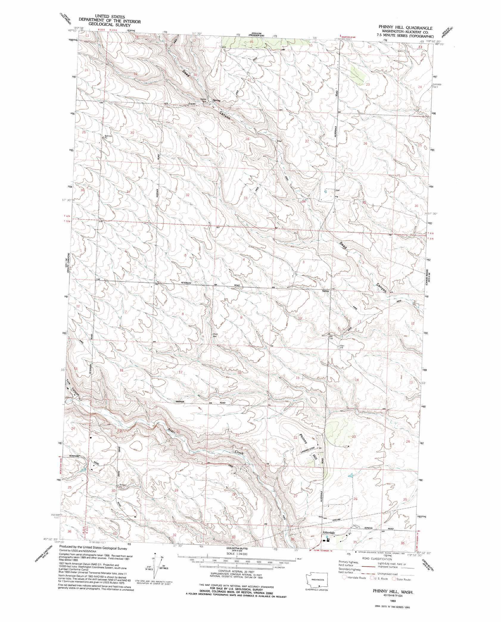
USGS Topo Quad 45119h8 - 1:24,000 scale
| Topo Map Name: | Phinny Hill |
| USGS Topo Quad ID: | 45119h8 |
| Print Size: | ca. 21 1/4" wide x 27" high |
| Southeast Coordinates: | 45.875° N latitude / 119.875° W longitude |
| Map Center Coordinates: | 45.9375° N latitude / 119.9375° W longitude |
| U.S. State: | WA |
| Filename: | o45119h8.jpg |
| Download Map JPG Image: | Phinny Hill topo map 1:24,000 scale |
| Map Type: | Topographic |
| Topo Series: | 7.5´ |
| Map Scale: | 1:24,000 |
| Source of Map Images: | United States Geological Survey (USGS) |
| Alternate Map Versions: |
Phinny Hill WA 1962, updated 1963 Download PDF Buy paper map Phinny Hill WA 1962, updated 1979 Download PDF Buy paper map Phinny Hill WA 1993, updated 1993 Download PDF Buy paper map Phinny Hill WA 2011 Download PDF Buy paper map Phinny Hill WA 2013 Download PDF Buy paper map |
1:24,000 Topo Quads surrounding Phinny Hill
Bluelight Nw |
Mabton West |
Mabton East |
Prosser |
Whitstran |
Bluelight |
Tule Prong |
Prosser Sw |
Prosser Se |
Lenzie Ranch |
Crider Valley |
Douty Canyon |
Phinny Hill |
Canoe Ridge |
Blalock Island |
Wood Gulch |
Heppner Junction |
Alderdale |
Crow Butte |
Boardman |
Arlington |
Horn Butte |
Dalreed Butte |
Ella |
Well Spring |
> Back to 45119e1 at 1:100,000 scale
> Back to 45118a1 at 1:250,000 scale
> Back to U.S. Topo Maps home
Phinny Hill topo map: Gazetteer
Phinny Hill: Summits
Phinny Hill elevation 240m 787′Phinny Hill: Valleys
Tule Canyon elevation 209m 685′Phinny Hill digital topo map on disk
Buy this Phinny Hill topo map showing relief, roads, GPS coordinates and other geographical features, as a high-resolution digital map file on DVD: