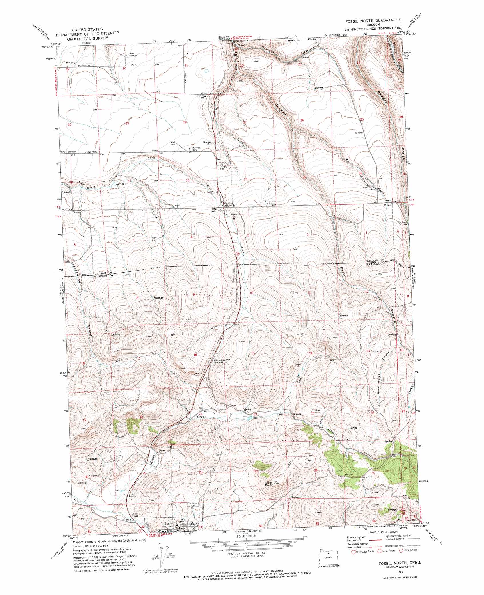
Fossil North Topo Map Oregon
To zoom in, hover over the map of Fossil North
USGS Topo Quad 45120a2 - 1:24,000 scale
| Topo Map Name: | Fossil North |
| USGS Topo Quad ID: | 45120a2 |
| Print Size: | ca. 21 1/4" wide x 27" high |
| Southeast Coordinates: | 45° N latitude / 120.125° W longitude |
| Map Center Coordinates: | 45.0625° N latitude / 120.1875° W longitude |
| U.S. State: | OR |
| Filename: | o45120a2.jpg |
| Download Map JPG Image: | Fossil North topo map 1:24,000 scale |
| Map Type: | Topographic |
| Topo Series: | 7.5´ |
| Map Scale: | 1:24,000 |
| Source of Map Images: | United States Geological Survey (USGS) |
| Alternate Map Versions: |
Fossil North OR 1970, updated 1973 Download PDF Buy paper map Fossil North OR 2011 Download PDF Buy paper map Fossil North OR 2014 Download PDF Buy paper map |
1:24,000 Topo Quads surrounding Fossil North
Indian Spring |
Igo Butte |
Gwendolen |
Devils Gap |
Gooseberry |
Shoestring Ridge |
Schott Canyon |
Condon |
Matney Flat |
Lone Rock Creek |
Chimney Springs |
Buckhorn Canyon |
Fossil North |
Salmon Fork |
Lonerock |
Clarno |
Porcupine Butte |
Fossil South |
Kinzua |
Wheeler Point |
Muddy Ranch |
Jennies Peak |
Rowe Creek |
Service Creek |
Massacre Mountain |
> Back to 45120a1 at 1:100,000 scale
> Back to 45120a1 at 1:250,000 scale
> Back to U.S. Topo Maps home
Fossil North topo map: Gazetteer
Fossil North: Airports
Putnams Airfield elevation 974m 3195′Fossil North: Gaps
Cummings Hill Summit elevation 1013m 3323′Fossil North: Parks
Dyer State Park elevation 740m 2427′Fossil North: Populated Places
Mayville elevation 903m 2962′Fossil North: Post Offices
Mayville Post Office elevation 903m 2962′Fossil North: Reservoirs
Hoover Creek Reservoir elevation 932m 3057′Fossil North: Streams
Dyer Creek elevation 754m 2473′Hoover Creek elevation 800m 2624′
Smith Creek elevation 826m 2709′
Fossil North: Summits
Black Butte elevation 1224m 4015′Fossil North: Valleys
Dead Horse Canyon elevation 1090m 3576′Ramsey Canyon elevation 745m 2444′
Fossil North digital topo map on disk
Buy this Fossil North topo map showing relief, roads, GPS coordinates and other geographical features, as a high-resolution digital map file on DVD: