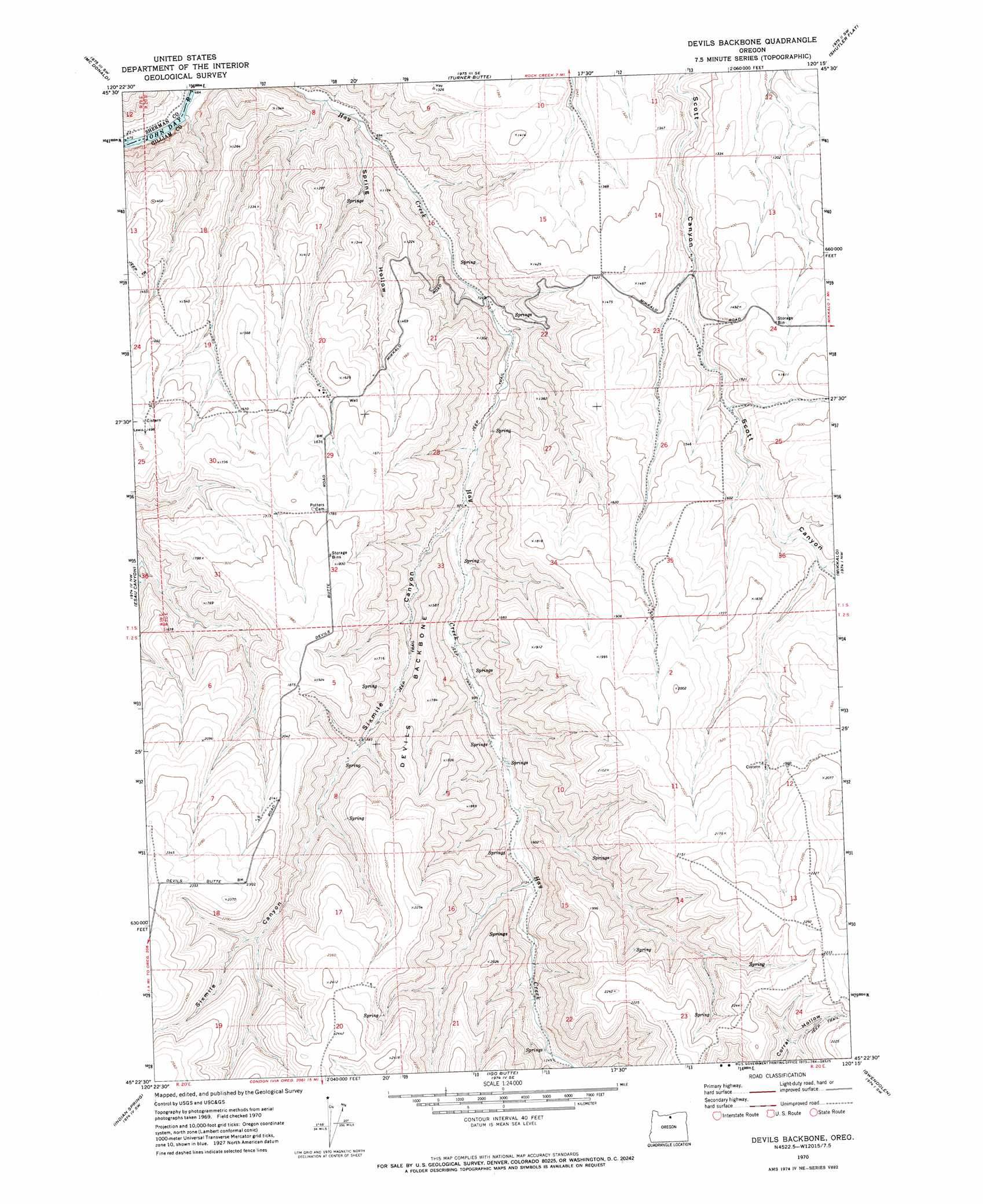
Devils Backbone Topo Map Oregon
To zoom in, hover over the map of Devils Backbone
USGS Topo Quad 45120d3 - 1:24,000 scale
| Topo Map Name: | Devils Backbone |
| USGS Topo Quad ID: | 45120d3 |
| Print Size: | ca. 21 1/4" wide x 27" high |
| Southeast Coordinates: | 45.375° N latitude / 120.25° W longitude |
| Map Center Coordinates: | 45.4375° N latitude / 120.3125° W longitude |
| U.S. State: | OR |
| Filename: | o45120d3.jpg |
| Download Map JPG Image: | Devils Backbone topo map 1:24,000 scale |
| Map Type: | Topographic |
| Topo Series: | 7.5´ |
| Map Scale: | 1:24,000 |
| Source of Map Images: | United States Geological Survey (USGS) |
| Alternate Map Versions: |
Devils Backbone OR 1970, updated 1973 Download PDF Buy paper map Devils Backbone OR 2011 Download PDF Buy paper map Devils Backbone OR 2014 Download PDF Buy paper map |
1:24,000 Topo Quads surrounding Devils Backbone
Quinton |
Sundale Nw |
Sundale |
Arlington |
Horn Butte |
Klondike |
Mcdonald |
Turner Butte |
Shutler Flat |
Hickland Butte |
Harmony |
Esau Canyon |
Devils Backbone |
Mikkalo |
Wolf Hollow Falls |
Indian Cove |
Indian Spring |
Igo Butte |
Gwendolen |
Devils Gap |
Horseshoe Bend |
Shoestring Ridge |
Schott Canyon |
Condon |
Matney Flat |
> Back to 45120a1 at 1:100,000 scale
> Back to 45120a1 at 1:250,000 scale
> Back to U.S. Topo Maps home
Devils Backbone topo map: Gazetteer
Devils Backbone: Ridges
Devils Backbone elevation 541m 1774′Devils Backbone: Springs
Sevenmile Spring elevation 470m 1541′Devils Backbone: Valleys
Sixmile Canyon elevation 267m 875′Spring Hollow elevation 179m 587′
Devils Backbone digital topo map on disk
Buy this Devils Backbone topo map showing relief, roads, GPS coordinates and other geographical features, as a high-resolution digital map file on DVD: