Harmony Topo Map Oregon
To zoom in, hover over the map of Harmony
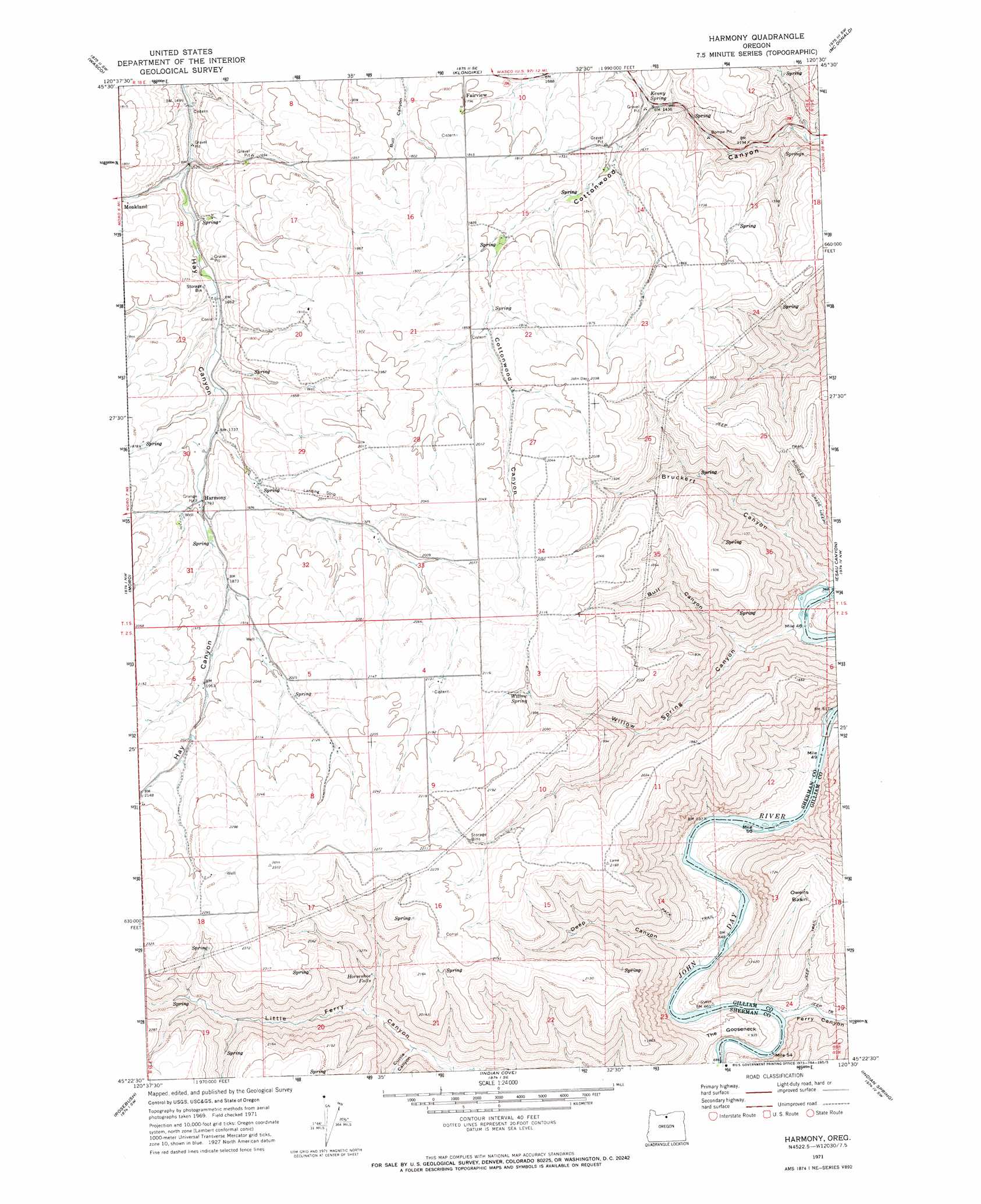
USGS Topo Quad 45120d5 - 1:24,000 scale
| Topo Map Name: | Harmony |
| USGS Topo Quad ID: | 45120d5 |
| Print Size: | ca. 21 1/4" wide x 27" high |
| Southeast Coordinates: | 45.375° N latitude / 120.5° W longitude |
| Map Center Coordinates: | 45.4375° N latitude / 120.5625° W longitude |
| U.S. State: | OR |
| Filename: | o45120d5.jpg |
| Download Map JPG Image: | Harmony topo map 1:24,000 scale |
| Map Type: | Topographic |
| Topo Series: | 7.5´ |
| Map Scale: | 1:24,000 |
| Source of Map Images: | United States Geological Survey (USGS) |
| Alternate Map Versions: |
Harmony OR 1971, updated 1973 Download PDF Buy paper map Harmony OR 2011 Download PDF Buy paper map Harmony OR 2014 Download PDF Buy paper map |
1:24,000 Topo Quads surrounding Harmony
Biggs Junction |
Rufus |
Quinton |
Sundale Nw |
Sundale |
Locust Grove |
Wasco |
Klondike |
Mcdonald |
Turner Butte |
Erskine |
Moro |
Harmony |
Esau Canyon |
Devils Backbone |
Grass Valley |
Rosebush |
Indian Cove |
Indian Spring |
Igo Butte |
Bronx Canyon |
Kent |
Horseshoe Bend |
Shoestring Ridge |
Schott Canyon |
> Back to 45120a1 at 1:100,000 scale
> Back to 45120a1 at 1:250,000 scale
> Back to U.S. Topo Maps home
Harmony topo map: Gazetteer
Harmony: Basins
Owens Basin elevation 351m 1151′Harmony: Bends
The Gooseneck elevation 258m 846′Harmony: Falls
Horseshoe Falls elevation 486m 1594′Harmony: Springs
Kenny Spring elevation 462m 1515′Willow Spring elevation 588m 1929′
Harmony: Valleys
Bruckert Canyon elevation 185m 606′Bull Canyon elevation 266m 872′
Currie Canyon elevation 346m 1135′
Deep Canyon elevation 209m 685′
Ferry Canyon elevation 210m 688′
Willow Spring Canyon elevation 183m 600′
Harmony digital topo map on disk
Buy this Harmony topo map showing relief, roads, GPS coordinates and other geographical features, as a high-resolution digital map file on DVD: