Luna Gulch Topo Map Washington
To zoom in, hover over the map of Luna Gulch
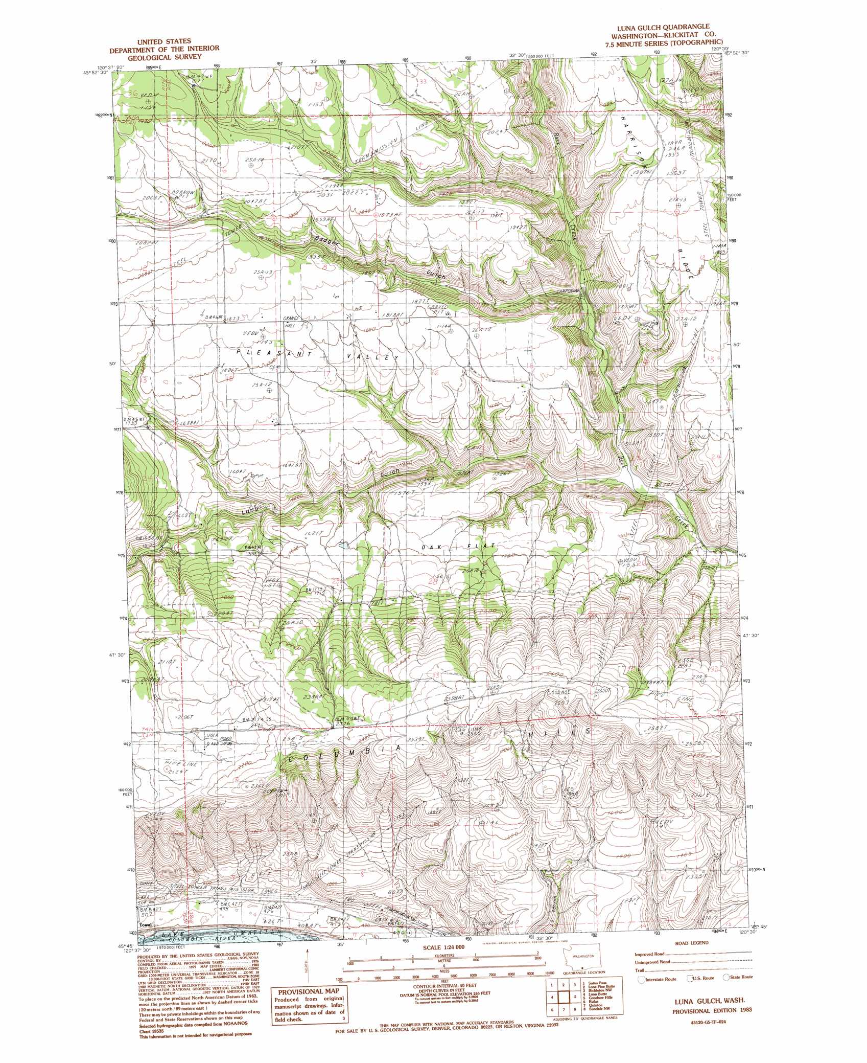
USGS Topo Quad 45120g5 - 1:24,000 scale
| Topo Map Name: | Luna Gulch |
| USGS Topo Quad ID: | 45120g5 |
| Print Size: | ca. 21 1/4" wide x 27" high |
| Southeast Coordinates: | 45.75° N latitude / 120.5° W longitude |
| Map Center Coordinates: | 45.8125° N latitude / 120.5625° W longitude |
| U.S. State: | WA |
| Filename: | o45120g5.jpg |
| Download Map JPG Image: | Luna Gulch topo map 1:24,000 scale |
| Map Type: | Topographic |
| Topo Series: | 7.5´ |
| Map Scale: | 1:24,000 |
| Source of Map Images: | United States Geological Survey (USGS) |
| Alternate Map Versions: |
Luna Gulch WA 1983, updated 1983 Download PDF Buy paper map Luna Gulch WA 2011 Download PDF Buy paper map Luna Gulch WA 2013 Download PDF Buy paper map |
1:24,000 Topo Quads surrounding Luna Gulch
Stagman Butte |
Logy Creek Sw |
Kusshi Creek |
Poisel Butte Sw |
Poisel Butte Se |
Indian Rock |
Status Pass |
Lone Pine Butte |
Bickleton Nw |
Bickleton |
Goldendale |
Luna Butte |
Luna Gulch |
Goodnoe Hills |
Dot |
Biggs Junction |
Rufus |
Quinton |
Sundale Nw |
Sundale |
Locust Grove |
Wasco |
Klondike |
Mcdonald |
Turner Butte |
> Back to 45120e1 at 1:100,000 scale
> Back to 45120a1 at 1:250,000 scale
> Back to U.S. Topo Maps home
Luna Gulch topo map: Gazetteer
Luna Gulch: Flats
Oak Flat elevation 484m 1587′Luna Gulch: Populated Places
Pleasant Valley elevation 551m 1807′Towal elevation 82m 269′
Luna Gulch: Ridges
Harrison Ridge elevation 493m 1617′Luna Gulch: Streams
North Luna Creek elevation 399m 1309′Luna Gulch: Valleys
Badger Gulch elevation 326m 1069′Luna Gulch elevation 275m 902′
Luna Gulch digital topo map on disk
Buy this Luna Gulch topo map showing relief, roads, GPS coordinates and other geographical features, as a high-resolution digital map file on DVD: