Lone Pine Butte Topo Map Washington
To zoom in, hover over the map of Lone Pine Butte
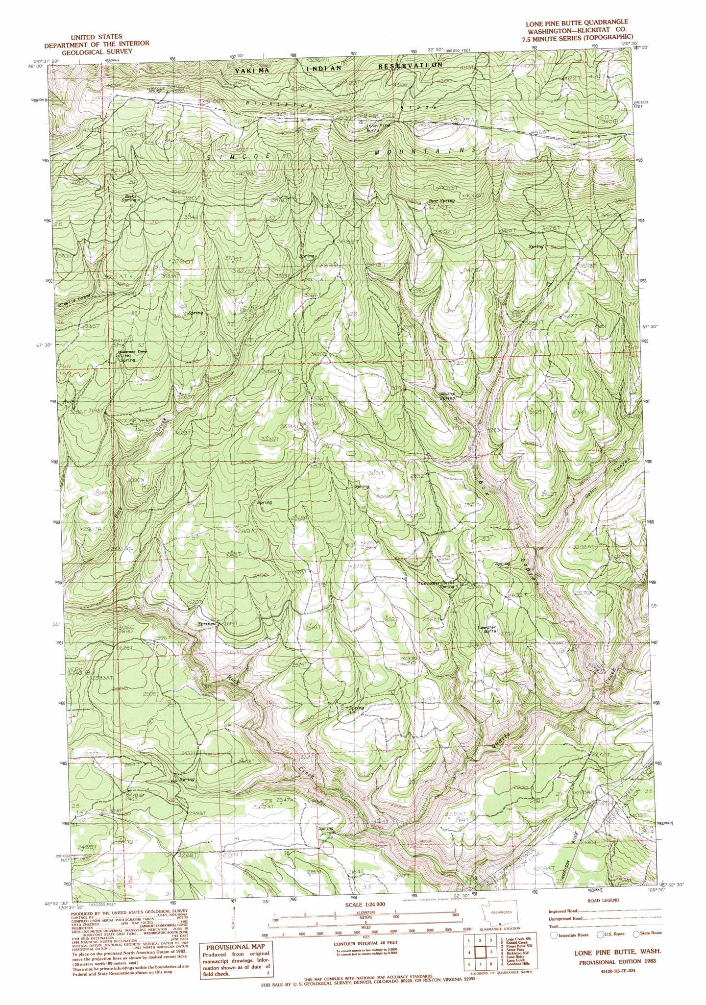
USGS Topo Quad 45120h5 - 1:24,000 scale
| Topo Map Name: | Lone Pine Butte |
| USGS Topo Quad ID: | 45120h5 |
| Print Size: | ca. 21 1/4" wide x 27" high |
| Southeast Coordinates: | 45.875° N latitude / 120.5° W longitude |
| Map Center Coordinates: | 45.9375° N latitude / 120.5625° W longitude |
| U.S. State: | WA |
| Filename: | o45120h5.jpg |
| Download Map JPG Image: | Lone Pine Butte topo map 1:24,000 scale |
| Map Type: | Topographic |
| Topo Series: | 7.5´ |
| Map Scale: | 1:24,000 |
| Source of Map Images: | United States Geological Survey (USGS) |
| Alternate Map Versions: |
Lone Pine Butte WA 1983, updated 1983 Download PDF Buy paper map Lone Pine Butte WA 2011 Download PDF Buy paper map Lone Pine Butte WA 2013 Download PDF Buy paper map |
1:24,000 Topo Quads surrounding Lone Pine Butte
Camas Patch |
Logy Creek Falls |
Logy Creek Ne |
Poisel Butte Nw |
Poisel Butte |
Stagman Butte |
Logy Creek Sw |
Kusshi Creek |
Poisel Butte Sw |
Poisel Butte Se |
Indian Rock |
Status Pass |
Lone Pine Butte |
Bickleton Nw |
Bickleton |
Goldendale |
Luna Butte |
Luna Gulch |
Goodnoe Hills |
Dot |
Biggs Junction |
Rufus |
Quinton |
Sundale Nw |
Sundale |
> Back to 45120e1 at 1:100,000 scale
> Back to 45120a1 at 1:250,000 scale
> Back to U.S. Topo Maps home
Lone Pine Butte topo map: Gazetteer
Lone Pine Butte: Springs
Bear Spring elevation 1157m 3795′Beeks Spring elevation 1197m 3927′
Stump Spring elevation 904m 2965′
Tumwater Corral Spring elevation 770m 2526′
Lone Pine Butte: Streams
Middle Fork Quartz Creek elevation 744m 2440′Quartz Creek elevation 439m 1440′
Lone Pine Butte: Summits
Lone Pine Butte elevation 1433m 4701′Tumwater Butte elevation 816m 2677′
Lone Pine Butte: Valleys
Box Canyon elevation 592m 1942′Dairy Canyon elevation 719m 2358′
Lone Pine Butte digital topo map on disk
Buy this Lone Pine Butte topo map showing relief, roads, GPS coordinates and other geographical features, as a high-resolution digital map file on DVD: