Status Pass Topo Map Washington
To zoom in, hover over the map of Status Pass
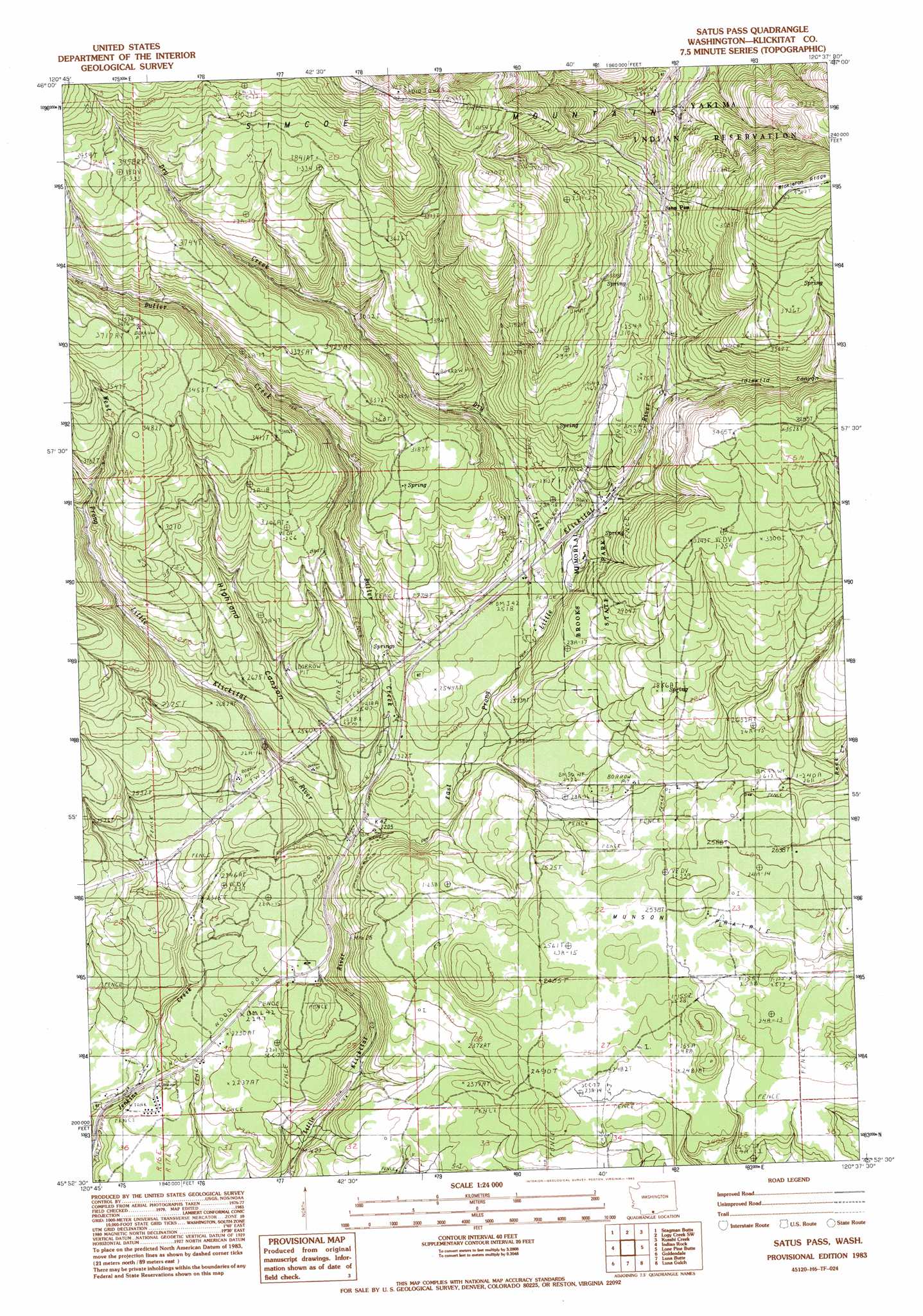
USGS Topo Quad 45120h6 - 1:24,000 scale
| Topo Map Name: | Status Pass |
| USGS Topo Quad ID: | 45120h6 |
| Print Size: | ca. 21 1/4" wide x 27" high |
| Southeast Coordinates: | 45.875° N latitude / 120.625° W longitude |
| Map Center Coordinates: | 45.9375° N latitude / 120.6875° W longitude |
| U.S. State: | WA |
| Filename: | o45120h6.jpg |
| Download Map JPG Image: | Status Pass topo map 1:24,000 scale |
| Map Type: | Topographic |
| Topo Series: | 7.5´ |
| Map Scale: | 1:24,000 |
| Source of Map Images: | United States Geological Survey (USGS) |
| Alternate Map Versions: |
Satus Pass WA 1983, updated 1983 Download PDF Buy paper map Satus Pass WA 2011 Download PDF Buy paper map Satus Pass WA 2013 Download PDF Buy paper map |
1:24,000 Topo Quads surrounding Status Pass
Mckays Butte |
Camas Patch |
Logy Creek Falls |
Logy Creek Ne |
Poisel Butte Nw |
Hagerty Butte |
Stagman Butte |
Logy Creek Sw |
Kusshi Creek |
Poisel Butte Sw |
White Pine Buttes |
Indian Rock |
Status Pass |
Lone Pine Butte |
Bickleton Nw |
Centerville |
Goldendale |
Luna Butte |
Luna Gulch |
Goodnoe Hills |
Wishram |
Biggs Junction |
Rufus |
Quinton |
Sundale Nw |
> Back to 45120e1 at 1:100,000 scale
> Back to 45120a1 at 1:250,000 scale
> Back to U.S. Topo Maps home
Status Pass topo map: Gazetteer
Status Pass: Flats
Munson Prairie elevation 768m 2519′Status Pass: Gaps
Satus Pass elevation 954m 3129′Status Pass: Parks
Brooks Memorial State Park elevation 1187m 3894′Status Pass: Ranges
Simcoe Mountains elevation 1146m 3759′Status Pass: Streams
Butler Creek elevation 685m 2247′Dry Creek elevation 747m 2450′
East Prong Little Klickitat River elevation 672m 2204′
West Prong Little Klickitat River elevation 669m 2194′
Status Pass: Valleys
Highland Canyon elevation 680m 2230′Idlewood Canyon elevation 881m 2890′
Status Pass digital topo map on disk
Buy this Status Pass topo map showing relief, roads, GPS coordinates and other geographical features, as a high-resolution digital map file on DVD: