Beaver Butte Topo Map Oregon
To zoom in, hover over the map of Beaver Butte
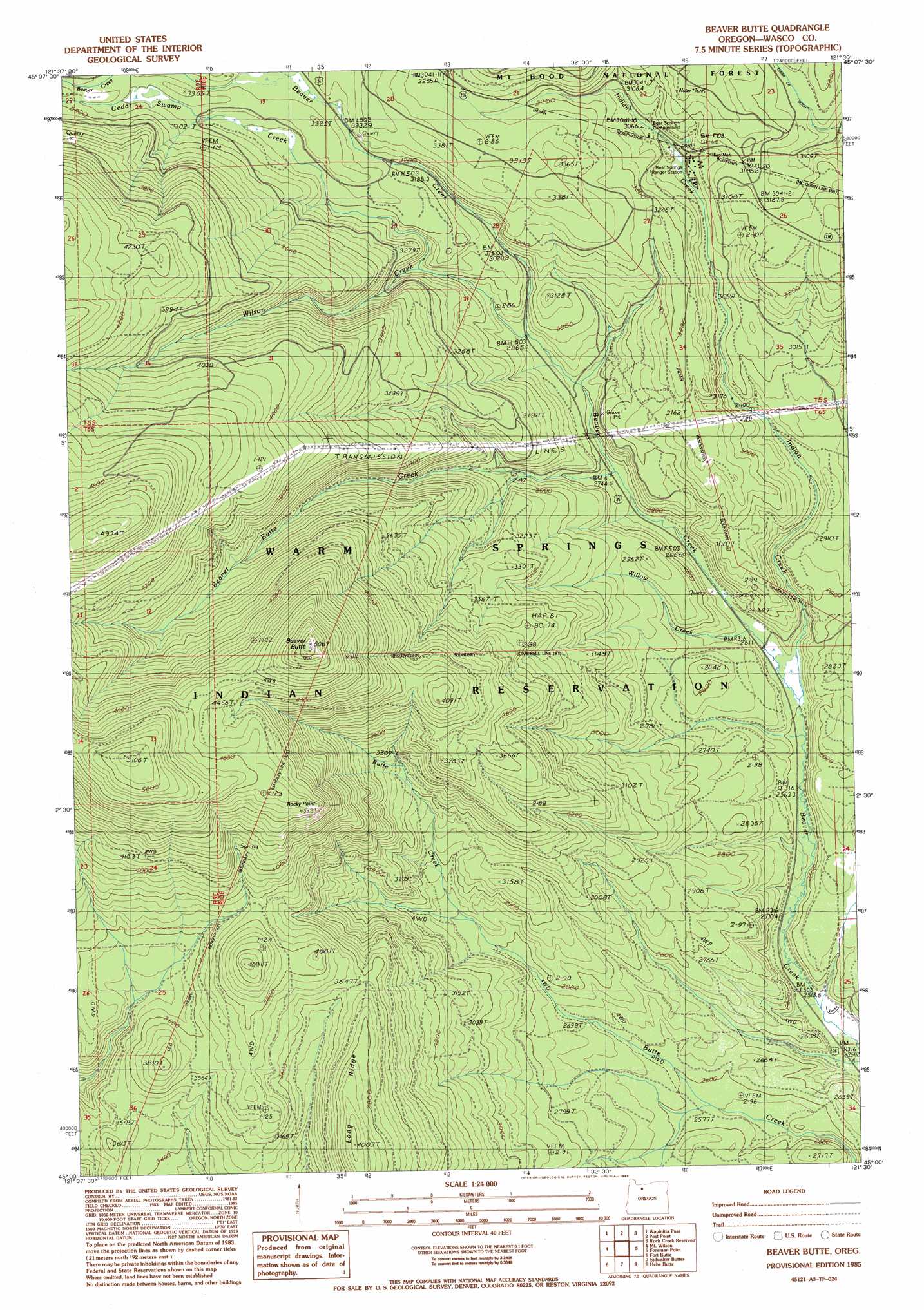
USGS Topo Quad 45121a5 - 1:24,000 scale
| Topo Map Name: | Beaver Butte |
| USGS Topo Quad ID: | 45121a5 |
| Print Size: | ca. 21 1/4" wide x 27" high |
| Southeast Coordinates: | 45° N latitude / 121.5° W longitude |
| Map Center Coordinates: | 45.0625° N latitude / 121.5625° W longitude |
| U.S. State: | OR |
| Filename: | o45121a5.jpg |
| Download Map JPG Image: | Beaver Butte topo map 1:24,000 scale |
| Map Type: | Topographic |
| Topo Series: | 7.5´ |
| Map Scale: | 1:24,000 |
| Source of Map Images: | United States Geological Survey (USGS) |
| Alternate Map Versions: |
Beaver Butte OR 1985, updated 1985 Download PDF Buy paper map Beaver Butte OR 1996, updated 1998 Download PDF Buy paper map Beaver Butte OR 2011 Download PDF Buy paper map Beaver Butte OR 2014 Download PDF Buy paper map |
| FStopo: | US Forest Service topo Beaver Butte is available: Download FStopo PDF Download FStopo TIF |
1:24,000 Topo Quads surrounding Beaver Butte
Government Camp |
Mount Hood South |
Badger Lake |
Flag Point |
Friend |
Wolf Peak |
Wapinitia Pass |
Post Point |
Rock Creek Reservoir |
Wamic |
Timothy Lake |
Mount Wilson |
Beaver Butte |
Foreman Point |
Wapinitia |
Pinhead Buttes |
Fort Butte |
Sidwalter Buttes |
Hehe Butte |
Simnasho |
Olallie Butte |
Boulder Lake |
Sawmill Butte |
Potters Ponds |
Warm Springs |
> Back to 45121a1 at 1:100,000 scale
> Back to 45120a1 at 1:250,000 scale
> Back to U.S. Topo Maps home
Beaver Butte topo map: Gazetteer
Beaver Butte: Areas
McQuinn Strip (historical) elevation 875m 2870′Persia M Robinson Natural Area elevation 859m 2818′
Beaver Butte: Ridges
Long Ridge elevation 1223m 4012′Beaver Butte: Springs
Bear Spring elevation 945m 3100′Beaver Butte: Streams
Beaver Butte Creek elevation 832m 2729′Cedar Swamp Creek elevation 926m 3038′
Cold Spring Creek elevation 861m 2824′
Cold Springs Creek elevation 855m 2805′
Indian Creek elevation 795m 2608′
Willow Creek elevation 803m 2634′
Wilson Creek elevation 875m 2870′
Beaver Butte: Summits
Beaver Butte elevation 1541m 5055′Rocky Point elevation 1382m 4534′
Beaver Butte: Trails
Beaver Creek Driveway elevation 884m 2900′Beaver Butte digital topo map on disk
Buy this Beaver Butte topo map showing relief, roads, GPS coordinates and other geographical features, as a high-resolution digital map file on DVD: