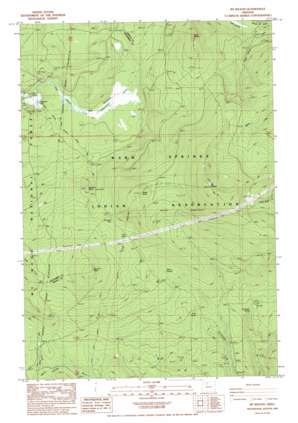
Mount Wilson Topo Map Oregon
To zoom in, hover over the map of Mount Wilson
USGS Topo Quad 45121a6 - 1:24,000 scale
| Topo Map Name: | Mount Wilson |
| USGS Topo Quad ID: | 45121a6 |
| Print Size: | ca. 21 1/4" wide x 27" high |
| Southeast Coordinates: | 45° N latitude / 121.625° W longitude |
| Map Center Coordinates: | 45.0625° N latitude / 121.6875° W longitude |
| U.S. State: | OR |
| Filename: | o45121a6.jpg |
| Download Map JPG Image: | Mount Wilson topo map 1:24,000 scale |
| Map Type: | Topographic |
| Topo Series: | 7.5´ |
| Map Scale: | 1:24,000 |
| Source of Map Images: | United States Geological Survey (USGS) |
| Alternate Map Versions: |
Mt. Wilson OR 1985, updated 1988 Download PDF Buy paper map Mount Wilson OR 1996, updated 1998 Download PDF Buy paper map Mount Wilson OR 2011 Download PDF Buy paper map Mount Wilson OR 2014 Download PDF Buy paper map |
| FStopo: | US Forest Service topo Mount Wilson is available: Download FStopo PDF Download FStopo TIF |
1:24,000 Topo Quads surrounding Mount Wilson
> Back to 45121a1 at 1:100,000 scale
> Back to 45120a1 at 1:250,000 scale
> Back to U.S. Topo Maps home
Mount Wilson topo map: Gazetteer
Mount Wilson: Gaps
Red Wolf Pass elevation 1252m 4107′Mount Wilson: Lakes
Clackamas Lake elevation 1018m 3339′Mount Wilson: Springs
Cold Spring elevation 1074m 3523′Deadman Spring elevation 1087m 3566′
Willow Springs elevation 1183m 3881′
Mount Wilson: Streams
Dry Creek elevation 1070m 3510′Mount Wilson: Summits
Buckskin Butte elevation 1248m 4094′Mount Wilson elevation 1682m 5518′
North Wilson elevation 1405m 4609′
Summit Butte elevation 1448m 4750′
Wests Butte elevation 1454m 4770′
Mount Wilson: Swamps
Big Meadows elevation 1055m 3461′Cedar Swamp elevation 1059m 3474′
Mount Wilson: Trails
Driveway Trail elevation 1145m 3756′Mount Wilson Trail elevation 1235m 4051′
Wilson Cove Trail elevation 1359m 4458′
Wilson Creek Driveway elevation 1363m 4471′
Mount Wilson digital topo map on disk
Buy this Mount Wilson topo map showing relief, roads, GPS coordinates and other geographical features, as a high-resolution digital map file on DVD:


