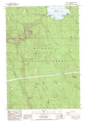
Timothy Lake Topo Map Oregon
To zoom in, hover over the map of Timothy Lake
USGS Topo Quad 45121a7 - 1:24,000 scale
| Topo Map Name: | Timothy Lake |
| USGS Topo Quad ID: | 45121a7 |
| Print Size: | ca. 21 1/4" wide x 27" high |
| Southeast Coordinates: | 45° N latitude / 121.75° W longitude |
| Map Center Coordinates: | 45.0625° N latitude / 121.8125° W longitude |
| U.S. State: | OR |
| Filename: | o45121a7.jpg |
| Download Map JPG Image: | Timothy Lake topo map 1:24,000 scale |
| Map Type: | Topographic |
| Topo Series: | 7.5´ |
| Map Scale: | 1:24,000 |
| Source of Map Images: | United States Geological Survey (USGS) |
| Alternate Map Versions: |
Timothy Lake OR 1985, updated 1985 Download PDF Buy paper map Timothy Lake OR 1997, updated 1999 Download PDF Buy paper map Timothy Lake OR 2011 Download PDF Buy paper map Timothy Lake OR 2014 Download PDF Buy paper map |
| FStopo: | US Forest Service topo Timothy Lake is available: Download FStopo PDF Download FStopo TIF |
1:24,000 Topo Quads surrounding Timothy Lake
> Back to 45121a1 at 1:100,000 scale
> Back to 45120a1 at 1:250,000 scale
> Back to U.S. Topo Maps home
Timothy Lake topo map: Gazetteer
Timothy Lake: Dams
Timothy Lake Dam elevation 985m 3231′Timothy Lake: Flats
Timothy Meadows (historical) elevation 985m 3231′Timothy Lake: Lakes
Buck Lake elevation 1253m 4110′Summit Lake elevation 1275m 4183′
Timothy Lake: Reservoirs
Timothy Lake elevation 990m 3248′Timothy Lake: Springs
Aquarius Spring elevation 996m 3267′Dry Creek Spring elevation 1172m 3845′
Fire Spring elevation 965m 3166′
Peavine Spring elevation 1254m 4114′
Rock Spring elevation 1230m 4035′
Sheep Spring elevation 1276m 4186′
Timothy Lake: Streams
Anvil Creek elevation 950m 3116′Buck Creek elevation 917m 3008′
Chief Creek elevation 820m 2690′
Dinger Creek elevation 993m 3257′
Snive Creek elevation 866m 2841′
Stone Creek elevation 924m 3031′
Timothy Lake: Summits
Peavine Mountain elevation 1457m 4780′Rock Butte elevation 1360m 4461′
Timothy Lake: Trails
Rock Springs Trail elevation 1155m 3789′Skyline Alternate Trail elevation 1057m 3467′
Summit Lake Trail elevation 1393m 4570′
Warm Springs Meadow Trail elevation 1291m 4235′
Timothy Lake digital topo map on disk
Buy this Timothy Lake topo map showing relief, roads, GPS coordinates and other geographical features, as a high-resolution digital map file on DVD:


