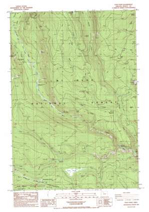
Post Point Topo Map Oregon
To zoom in, hover over the map of Post Point
USGS Topo Quad 45121b5 - 1:24,000 scale
| Topo Map Name: | Post Point |
| USGS Topo Quad ID: | 45121b5 |
| Print Size: | ca. 21 1/4" wide x 27" high |
| Southeast Coordinates: | 45.125° N latitude / 121.5° W longitude |
| Map Center Coordinates: | 45.1875° N latitude / 121.5625° W longitude |
| U.S. State: | OR |
| Filename: | o45121b5.jpg |
| Download Map JPG Image: | Post Point topo map 1:24,000 scale |
| Map Type: | Topographic |
| Topo Series: | 7.5´ |
| Map Scale: | 1:24,000 |
| Source of Map Images: | United States Geological Survey (USGS) |
| Alternate Map Versions: |
Post Point OR 1985, updated 1985 Download PDF Buy paper map Post Point OR 1996, updated 1998 Download PDF Buy paper map Post Point OR 2011 Download PDF Buy paper map Post Point OR 2014 Download PDF Buy paper map |
| FStopo: | US Forest Service topo Post Point is available: Download FStopo PDF Download FStopo TIF |
1:24,000 Topo Quads surrounding Post Point
> Back to 45121a1 at 1:100,000 scale
> Back to 45120a1 at 1:250,000 scale
> Back to U.S. Topo Maps home
Post Point topo map: Gazetteer
Post Point: Canals
Clear Creek Ditch elevation 983m 3225′Post Point: Cliffs
Dobry Point elevation 1221m 4005′Post Point: Springs
Bell Spring elevation 1254m 4114′Charity Spring elevation 1015m 3330′
Faith Spring elevation 888m 2913′
Post Point: Streams
Barlow Creek elevation 903m 2962′Bonney Creek elevation 941m 3087′
Boulder Creek elevation 742m 2434′
Camas Creek elevation 895m 2936′
Cedar Creek elevation 897m 2942′
Clear Creek elevation 764m 2506′
Deep Creek elevation 823m 2700′
Frog Creek elevation 906m 2972′
Green Lake Creek elevation 935m 3067′
Lost Creek elevation 944m 3097′
Red Creek elevation 958m 3143′
Swamp Creek elevation 1223m 4012′
Post Point: Summits
Boulder Point elevation 1075m 3526′Post Point elevation 1110m 3641′
Post Point: Swamps
Camas Prairie elevation 962m 3156′Post Point: Trails
Bonney Meadows Trail elevation 1339m 4393′East West Trail elevation 1184m 3884′
Forest Creek Trail elevation 1172m 3845′
Frog Creek Trail elevation 1116m 3661′
Little Boulder Way Trail elevation 1378m 4520′
Rimrock Trail elevation 940m 3083′
Swamp Creek Hidden Meadows Trail elevation 1338m 4389′
Post Point digital topo map on disk
Buy this Post Point topo map showing relief, roads, GPS coordinates and other geographical features, as a high-resolution digital map file on DVD:


