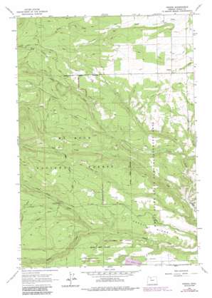
Friend Topo Map Oregon
To zoom in, hover over the map of Friend
USGS Topo Quad 45121c3 - 1:24,000 scale
| Topo Map Name: | Friend |
| USGS Topo Quad ID: | 45121c3 |
| Print Size: | ca. 21 1/4" wide x 27" high |
| Southeast Coordinates: | 45.25° N latitude / 121.25° W longitude |
| Map Center Coordinates: | 45.3125° N latitude / 121.3125° W longitude |
| U.S. State: | OR |
| Filename: | o45121c3.jpg |
| Download Map JPG Image: | Friend topo map 1:24,000 scale |
| Map Type: | Topographic |
| Topo Series: | 7.5´ |
| Map Scale: | 1:24,000 |
| Source of Map Images: | United States Geological Survey (USGS) |
| Alternate Map Versions: |
Friend OR 1962, updated 1964 Download PDF Buy paper map Friend OR 1962, updated 1978 Download PDF Buy paper map Friend OR 1962, updated 1987 Download PDF Buy paper map Friend OR 1996, updated 1998 Download PDF Buy paper map Friend OR 2011 Download PDF Buy paper map Friend OR 2014 Download PDF Buy paper map |
| FStopo: | US Forest Service topo Friend is available: Download FStopo PDF Download FStopo TIF |
1:24,000 Topo Quads surrounding Friend
> Back to 45121a1 at 1:100,000 scale
> Back to 45120a1 at 1:250,000 scale
> Back to U.S. Topo Maps home
Friend topo map: Gazetteer
Friend: Canals
Highland Ditch elevation 618m 2027′Friend: Populated Places
Friend elevation 746m 2447′Friend: Post Offices
Friend Post Office elevation 746m 2447′Friend: Ridges
Happy Ridge elevation 574m 1883′Friend: Streams
Jordan Creek elevation 406m 1332′Little Badger Creek elevation 509m 1669′
Pen Creek elevation 565m 1853′
Sherar Springs Creek elevation 443m 1453′
Friend: Valleys
Gurley Canyon elevation 491m 1610′Owl Hollow elevation 777m 2549′
Friend digital topo map on disk
Buy this Friend topo map showing relief, roads, GPS coordinates and other geographical features, as a high-resolution digital map file on DVD:


