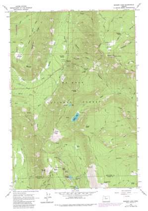
Badger Lake Topo Map Oregon
To zoom in, hover over the map of Badger Lake
USGS Topo Quad 45121c5 - 1:24,000 scale
| Topo Map Name: | Badger Lake |
| USGS Topo Quad ID: | 45121c5 |
| Print Size: | ca. 21 1/4" wide x 27" high |
| Southeast Coordinates: | 45.25° N latitude / 121.5° W longitude |
| Map Center Coordinates: | 45.3125° N latitude / 121.5625° W longitude |
| U.S. State: | OR |
| Filename: | o45121c5.jpg |
| Download Map JPG Image: | Badger Lake topo map 1:24,000 scale |
| Map Type: | Topographic |
| Topo Series: | 7.5´ |
| Map Scale: | 1:24,000 |
| Source of Map Images: | United States Geological Survey (USGS) |
| Alternate Map Versions: |
Badger Lake OR 1962, updated 1964 Download PDF Buy paper map Badger Lake OR 1962, updated 1973 Download PDF Buy paper map Badger Lake OR 1962, updated 1980 Download PDF Buy paper map Badger Lake OR 1979 Download PDF Buy paper map Badger Lake OR 1996, updated 1998 Download PDF Buy paper map Badger Lake OR 2011 Download PDF Buy paper map Badger Lake OR 2014 Download PDF Buy paper map |
| FStopo: | US Forest Service topo Badger Lake is available: Download FStopo PDF Download FStopo TIF |
1:24,000 Topo Quads surrounding Badger Lake
> Back to 45121a1 at 1:100,000 scale
> Back to 45120a1 at 1:250,000 scale
> Back to U.S. Topo Maps home
Badger Lake topo map: Gazetteer
Badger Lake: Dams
Badger Lake Dam elevation 1365m 4478′Badger Lake: Flats
Bonney Meadows elevation 1585m 5200′Crane Prairie elevation 1296m 4251′
Elk Meadows elevation 1548m 5078′
High Prairie elevation 1844m 6049′
Horsethief Meadows elevation 1091m 3579′
Badger Lake: Gaps
Gumjuwac Saddle elevation 1594m 5229′Badger Lake: Lakes
Boulder Lake elevation 1386m 4547′Little Boulder Lake elevation 1405m 4609′
Badger Lake: Reservoirs
Badger Lake elevation 1366m 4481′Jean Lake elevation 1617m 5305′
Spinning Lake elevation 1372m 4501′
Badger Lake: Ridges
Bluegrass Ridge elevation 1529m 5016′Badger Lake: Springs
Dog River Springs elevation 1777m 5830′Jack Springs elevation 1619m 5311′
Kane Springs elevation 1455m 4773′
Senecal Spring elevation 1904m 6246′
Badger Lake: Streams
Clark Creek elevation 1169m 3835′Engineers Creek elevation 1048m 3438′
Gumjuwac Creek elevation 1166m 3825′
Hellroaring Creek elevation 1070m 3510′
Iron Creek elevation 978m 3208′
Jalland Creek elevation 994m 3261′
Lunch Creek elevation 1014m 3326′
Meadows Creek elevation 1178m 3864′
Mine Creek elevation 1093m 3585′
Newton Creek elevation 1097m 3599′
Pocket Creek elevation 1199m 3933′
Robinhood Creek elevation 1009m 3310′
South Fork Cold Spring Creek elevation 1495m 4904′
Tolo Creek elevation 1059m 3474′
Badger Lake: Summits
Badger Butte elevation 1820m 5971′Bonney Butte elevation 1701m 5580′
Echo Point elevation 1652m 5419′
Elk Mountain elevation 1712m 5616′
Grasshopper Point elevation 1641m 5383′
Gunsight Butte elevation 1799m 5902′
Lookout Mountain elevation 1990m 6528′
Rocky Butte elevation 1455m 4773′
Badger Lake: Trails
Boulder Lake Trail elevation 1335m 4379′Boulder Lake Way Trail elevation 1495m 4904′
Elk Meadows Trail elevation 1455m 4773′
Flag Point Trail elevation 1181m 3874′
Lookout Mountain Trail elevation 1740m 5708′
Pine Creek Trail elevation 1445m 4740′
Rocky Butte Way Trail elevation 1502m 4927′
Badger Lake: Valleys
Buck Draw elevation 1269m 4163′Badger Lake digital topo map on disk
Buy this Badger Lake topo map showing relief, roads, GPS coordinates and other geographical features, as a high-resolution digital map file on DVD:


