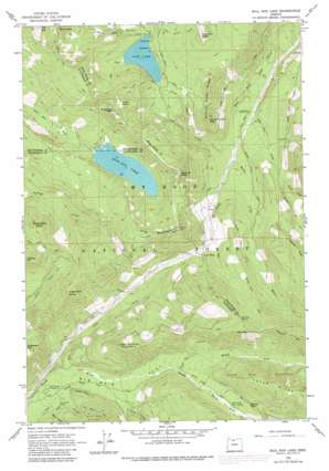
Bull Run Lake Topo Map Oregon
To zoom in, hover over the map of Bull Run Lake
USGS Topo Quad 45121d7 - 1:24,000 scale
| Topo Map Name: | Bull Run Lake |
| USGS Topo Quad ID: | 45121d7 |
| Print Size: | ca. 21 1/4" wide x 27" high |
| Southeast Coordinates: | 45.375° N latitude / 121.75° W longitude |
| Map Center Coordinates: | 45.4375° N latitude / 121.8125° W longitude |
| U.S. State: | OR |
| Filename: | o45121d7.jpg |
| Download Map JPG Image: | Bull Run Lake topo map 1:24,000 scale |
| Map Type: | Topographic |
| Topo Series: | 7.5´ |
| Map Scale: | 1:24,000 |
| Source of Map Images: | United States Geological Survey (USGS) |
| Alternate Map Versions: |
Bull Run Lake OR 1962, updated 1964 Download PDF Buy paper map Bull Run Lake OR 1962, updated 1974 Download PDF Buy paper map Bull Run Lake OR 1962, updated 1980 Download PDF Buy paper map Bull Run Lake OR 1997, updated 1999 Download PDF Buy paper map Bull Run Lake OR 2011 Download PDF Buy paper map Bull Run Lake OR 2014 Download PDF Buy paper map |
| FStopo: | US Forest Service topo Bull Run Lake is available: Download FStopo PDF Download FStopo TIF |
1:24,000 Topo Quads surrounding Bull Run Lake
> Back to 45121a1 at 1:100,000 scale
> Back to 45120a1 at 1:250,000 scale
> Back to U.S. Topo Maps home
Bull Run Lake topo map: Gazetteer
Bull Run Lake: Dams
Bull Run Lake Dam elevation 969m 3179′Bull Run Lake: Falls
Ramona Falls elevation 1090m 3576′Bull Run Lake: Flats
Old Maid Flat elevation 739m 2424′Bull Run Lake: Gaps
Lolo Pass elevation 1042m 3418′Bull Run Lake: Islands
Dodge Island elevation 969m 3179′Bull Run Lake: Lakes
Blue Lake elevation 1150m 3772′Bull Run Lake elevation 969m 3179′
Lost Lake elevation 959m 3146′
Bull Run Lake: Parks
Bull Run Research Natural Area elevation 1059m 3474′Bull Run Lake: Populated Places
Lost Lake Resort elevation 972m 3188′Bull Run Lake: Ridges
Bald Mountain Ridge elevation 1481m 4858′Butcher Knife Ridge elevation 1147m 3763′
Bull Run Lake: Springs
Salvation Spring elevation 1254m 4114′Bull Run Lake: Streams
Cast Creek elevation 606m 1988′Clear Fork elevation 634m 2080′
Elk Creek elevation 706m 2316′
Inlet Creek elevation 959m 3146′
Jones Creek elevation 694m 2276′
Ladd Creek elevation 650m 2132′
McGee Creek elevation 694m 2276′
Muddy Fork elevation 804m 2637′
Red Hill Creek elevation 627m 2057′
Rushing Water Creek elevation 1014m 3326′
Short Creek elevation 609m 1998′
Stump Creek elevation 878m 2880′
Bull Run Lake: Summits
Bald Mountain elevation 1394m 4573′Blazed Alder Butte elevation 1258m 4127′
Buck Peak elevation 1443m 4734′
Butcher Peak elevation 1141m 3743′
Cape Horn elevation 770m 2526′
Clear Fork Butte elevation 1269m 4163′
Devils Pulpit elevation 1360m 4461′
Hiyu Mountain elevation 1401m 4596′
Last Chance Mountain elevation 1199m 3933′
Lost Lake Butte elevation 1338m 4389′
Preachers Peak elevation 1367m 4484′
Sentinel Peak elevation 1373m 4504′
Bull Run Lake: Trails
Blazed Alder Way Trail elevation 1297m 4255′Bull Run Lake Trail elevation 1033m 3389′
Chitwood Trail elevation 1376m 4514′
Huckleberry Mountain Trail elevation 1176m 3858′
Lost Lake Butte Trail elevation 1150m 3772′
Portage Trail elevation 859m 2818′
Sandy River Trail elevation 931m 3054′
Table Mountain Trail elevation 1304m 4278′
Bull Run Lake digital topo map on disk
Buy this Bull Run Lake topo map showing relief, roads, GPS coordinates and other geographical features, as a high-resolution digital map file on DVD:


