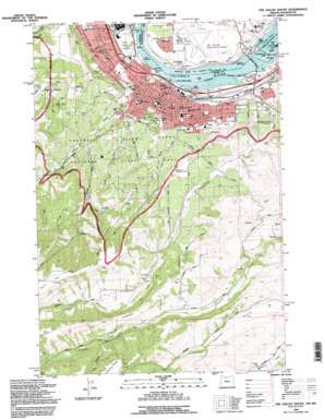
The Dalles South Topo Map Oregon
To zoom in, hover over the map of The Dalles South
USGS Topo Quad 45121e2 - 1:24,000 scale
| Topo Map Name: | The Dalles South |
| USGS Topo Quad ID: | 45121e2 |
| Print Size: | ca. 21 1/4" wide x 27" high |
| Southeast Coordinates: | 45.5° N latitude / 121.125° W longitude |
| Map Center Coordinates: | 45.5625° N latitude / 121.1875° W longitude |
| U.S. States: | OR, WA |
| Filename: | o45121e2.jpg |
| Download Map JPG Image: | The Dalles South topo map 1:24,000 scale |
| Map Type: | Topographic |
| Topo Series: | 7.5´ |
| Map Scale: | 1:24,000 |
| Source of Map Images: | United States Geological Survey (USGS) |
| Alternate Map Versions: |
The Dalles South OR 1975, updated 1980 Download PDF Buy paper map The Dalles South OR 1977, updated 1978 Download PDF Buy paper map The Dalles South OR 1994, updated 1995 Download PDF Buy paper map The Dalles South OR 2011 Download PDF Buy paper map The Dalles South OR 2014 Download PDF Buy paper map |
| FStopo: | US Forest Service topo The Dalles South is available: Download FStopo PDF Download FStopo TIF |
1:24,000 Topo Quads surrounding The Dalles South
> Back to 45121e1 at 1:100,000 scale
> Back to 45120a1 at 1:250,000 scale
> Back to U.S. Topo Maps home
The Dalles South topo map: Gazetteer
The Dalles South: Airports
Mill Creek Field elevation 77m 252′The Dalles Municipal Airport elevation 68m 223′
The Dalles South: Bridges
The Dalles Bridge elevation 24m 78′The Dalles Bridge elevation 24m 78′
The Dalles South: Capes
Covington Point elevation 28m 91′Threemile Point elevation 40m 131′
The Dalles South: Dams
The Dalles Dam elevation 24m 78′The Dalles South: Falls
The Dalles (historical) elevation 24m 78′The Dalles South: Islands
Lone Pine Island elevation 25m 82′The Dalles South: Parks
Hess Park elevation 60m 196′Howe Park elevation 93m 305′
Seufert County Park elevation 30m 98′
Sorosis Park elevation 182m 597′
Thompson Park elevation 37m 121′
The Dalles South: Pillars
Pulpit Rock elevation 475m 1558′The Dalles South: Populated Places
Cherry Heights elevation 359m 1177′Dallesport elevation 65m 213′
The Dalles elevation 77m 252′
The Dalles South: Post Offices
The Dalles Post Office elevation 77m 252′The Dalles South: Rapids
Threemile Rapids elevation 24m 78′Threemile Rapids (historical) elevation 24m 78′
The Dalles South: Reservoirs
Hazeldell Orchards Reservoir elevation 106m 347′Lake Celilo elevation 51m 167′
Lake Celilo elevation 50m 164′
Sorosis Reservoir elevation 197m 646′
The Dalles South: Ridges
The Hogback elevation 419m 1374′The Dalles South: Springs
Anderson Spring elevation 190m 623′The Dalles South: Streams
Mill Creek elevation 30m 98′Threemile Creek elevation 24m 78′
The Dalles South: Valleys
Dry Hollow elevation 136m 446′Whisky Gulch elevation 91m 298′
The Dalles South digital topo map on disk
Buy this The Dalles South topo map showing relief, roads, GPS coordinates and other geographical features, as a high-resolution digital map file on DVD:


