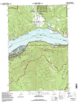
Carson Topo Map Oregon
To zoom in, hover over the map of Carson
USGS Topo Quad 45121f7 - 1:24,000 scale
| Topo Map Name: | Carson |
| USGS Topo Quad ID: | 45121f7 |
| Print Size: | ca. 21 1/4" wide x 27" high |
| Southeast Coordinates: | 45.625° N latitude / 121.75° W longitude |
| Map Center Coordinates: | 45.6875° N latitude / 121.8125° W longitude |
| U.S. States: | OR, WA |
| Filename: | o45121f7.jpg |
| Download Map JPG Image: | Carson topo map 1:24,000 scale |
| Map Type: | Topographic |
| Topo Series: | 7.5´ |
| Map Scale: | 1:24,000 |
| Source of Map Images: | United States Geological Survey (USGS) |
| Alternate Map Versions: |
Carson WA 1994, updated 1996 Download PDF Buy paper map Carson WA 2011 Download PDF Buy paper map Carson WA 2014 Download PDF Buy paper map |
| FStopo: | US Forest Service topo Carson is available: Download FStopo PDF Download FStopo TIF |
1:24,000 Topo Quads surrounding Carson
> Back to 45121e1 at 1:100,000 scale
> Back to 45120a1 at 1:250,000 scale
> Back to U.S. Topo Maps home
Carson topo map: Gazetteer
Carson: Bays
Government Cove elevation 24m 78′Carson: Capes
Anderson Point elevation 24m 78′Trotter Point elevation 38m 124′
Carson: Channels
Wind Mountain Lower Range Channel elevation 24m 78′Carson: Dams
Berge Reservoir Dam elevation 311m 1020′Carson: Falls
Shipherd Falls elevation 57m 187′Carson: Lakes
North Lake elevation 1217m 3992′Rainy Lake elevation 1249m 4097′
Carson: Parks
Lang Forest State Park elevation 82m 269′Wyeth State Park elevation 45m 147′
Carson: Plains
Benson Plateau elevation 1218m 3996′Carson: Populated Places
Carson elevation 143m 469′Home Valley elevation 24m 78′
Saint Martins Hot Springs elevation 81m 265′
Carson: Post Offices
Shell Rock Post Office (historical) elevation 46m 150′Wyeth Post Office (historical) elevation 45m 147′
Carson: Reservoirs
Berge Reservoir elevation 311m 1020′Carson: Ridges
Nick Eaton Ridge elevation 1213m 3979′Woolly Horn Ridge elevation 1121m 3677′
Carson: Springs
Cascade Spring elevation 127m 416′East Spring elevation 73m 239′
Minott Spring elevation 104m 341′
Saint Martins Hot Springs elevation 98m 321′
Teakettle Spring elevation 1038m 3405′
Carson: Streams
Berge Creek elevation 90m 295′Brush Creek elevation 73m 239′
Camp Creek elevation 294m 964′
Carson Creek elevation 24m 78′
Casey Creek elevation 343m 1125′
East Fork Herman Creek elevation 315m 1033′
Gorton Creek elevation 28m 91′
Grays Creek elevation 142m 465′
Harphan Creek elevation 35m 114′
Hazel Creek elevation 418m 1371′
Herman Creek elevation 26m 85′
Little Herman Creek elevation 59m 193′
Little Wind River elevation 56m 183′
Moore Creek elevation 146m 479′
Mullinix Creek elevation 529m 1735′
Nelson Creek elevation 24m 78′
Slide Creek elevation 493m 1617′
Souther Creek elevation 30m 98′
Whisky Creek elevation 612m 2007′
Wind River elevation 24m 78′
Carson: Summits
Buck Mountain elevation 397m 1302′Green Point Mountain elevation 1433m 4701′
Wind Mountain elevation 571m 1873′
Carson: Trails
Herman Creek Trail elevation 724m 2375′Wyeth Trail elevation 1188m 3897′
Carson digital topo map on disk
Buy this Carson topo map showing relief, roads, GPS coordinates and other geographical features, as a high-resolution digital map file on DVD:


