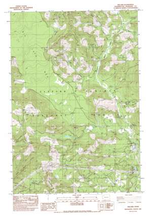
Willard Topo Map Washington
To zoom in, hover over the map of Willard
USGS Topo Quad 45121g6 - 1:24,000 scale
| Topo Map Name: | Willard |
| USGS Topo Quad ID: | 45121g6 |
| Print Size: | ca. 21 1/4" wide x 27" high |
| Southeast Coordinates: | 45.75° N latitude / 121.625° W longitude |
| Map Center Coordinates: | 45.8125° N latitude / 121.6875° W longitude |
| U.S. State: | WA |
| Filename: | o45121g6.jpg |
| Download Map JPG Image: | Willard topo map 1:24,000 scale |
| Map Type: | Topographic |
| Topo Series: | 7.5´ |
| Map Scale: | 1:24,000 |
| Source of Map Images: | United States Geological Survey (USGS) |
| Alternate Map Versions: |
Willard WA 1983, updated 1983 Download PDF Buy paper map Willard WA 1994, updated 1997 Download PDF Buy paper map Willard WA 2011 Download PDF Buy paper map Willard WA 2014 Download PDF Buy paper map |
| FStopo: | US Forest Service topo Willard is available: Download FStopo PDF Download FStopo TIF |
1:24,000 Topo Quads surrounding Willard
> Back to 45121e1 at 1:100,000 scale
> Back to 45120a1 at 1:250,000 scale
> Back to U.S. Topo Maps home
Willard topo map: Gazetteer
Willard: Gaps
Triangle Pass elevation 495m 1624′Willard: Lakes
Larson Lakes elevation 607m 1991′Willard: Parks
Big Cedars County Park elevation 403m 1322′Willard: Populated Places
Mill A elevation 313m 1026′Willard elevation 381m 1250′
Willard: Streams
Berry Creek elevation 482m 1581′Cabbage Creek elevation 447m 1466′
Homes Creek elevation 495m 1624′
Lapham Creek elevation 278m 912′
Lava Creek elevation 378m 1240′
Lost Creek elevation 510m 1673′
Lusk Creek elevation 492m 1614′
Moss Creek elevation 403m 1322′
North Fork Berry Creek elevation 512m 1679′
Pine Creek elevation 366m 1200′
South Fork Berry Creek elevation 512m 1679′
Wilson Creek elevation 418m 1371′
Willard: Summits
Goat Point elevation 694m 2276′Hauk Butte elevation 849m 2785′
Shingle Mountain elevation 725m 2378′
Willard: Trails
Goat Point Trail elevation 694m 2276′Nestor Peak Trail elevation 575m 1886′
Willard digital topo map on disk
Buy this Willard topo map showing relief, roads, GPS coordinates and other geographical features, as a high-resolution digital map file on DVD:


