Grayback Mountain Topo Map Washington
To zoom in, hover over the map of Grayback Mountain
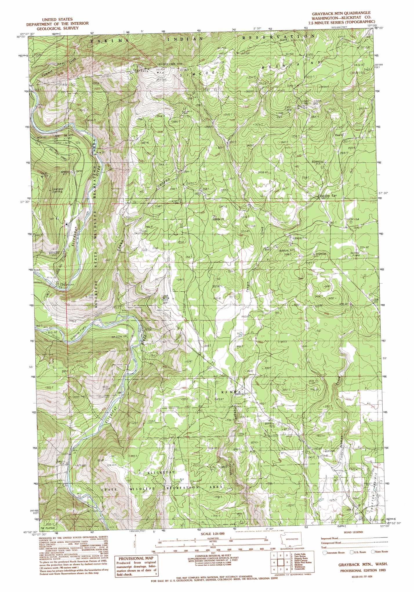
USGS Topo Quad 45121h1 - 1:24,000 scale
| Topo Map Name: | Grayback Mountain |
| USGS Topo Quad ID: | 45121h1 |
| Print Size: | ca. 21 1/4" wide x 27" high |
| Southeast Coordinates: | 45.875° N latitude / 121° W longitude |
| Map Center Coordinates: | 45.9375° N latitude / 121.0625° W longitude |
| U.S. State: | WA |
| Filename: | o45121h1.jpg |
| Download Map JPG Image: | Grayback Mountain topo map 1:24,000 scale |
| Map Type: | Topographic |
| Topo Series: | 7.5´ |
| Map Scale: | 1:24,000 |
| Source of Map Images: | United States Geological Survey (USGS) |
| Alternate Map Versions: |
Grayback Mtn WA 1983, updated 1983 Download PDF Buy paper map Grayback Mountain WA 2011 Download PDF Buy paper map Grayback Mountain WA 2014 Download PDF Buy paper map |
1:24,000 Topo Quads surrounding Grayback Mountain
Jungle Butte |
Signal Peak |
Poland Butte |
Mckays Butte |
Camas Patch |
Glenwood |
Outlet Falls |
Twin Buttes |
Hagerty Butte |
Stagman Butte |
Camas Prairie |
Dead Canyon |
Grayback Mountain |
White Pine Buttes |
Indian Rock |
Appleton |
Klickitat |
Wahkiacus |
Centerville |
Goldendale |
Lyle |
The Dalles North |
Stacker Butte |
Wishram |
Biggs Junction |
> Back to 45121e1 at 1:100,000 scale
> Back to 45120a1 at 1:250,000 scale
> Back to U.S. Topo Maps home
Grayback Mountain topo map: Gazetteer
Grayback Mountain: Flats
Quiney Flats elevation 720m 2362′Stimpson Flats elevation 241m 790′
Grayback Mountain: Springs
Shelton Spring elevation 706m 2316′Grayback Mountain: Streams
Summit Creek elevation 312m 1023′Grayback Mountain: Summits
Grayback Mountain elevation 1129m 3704′Grayback Mountain: Valleys
Beeks Canyon elevation 212m 695′Sheep Canyon elevation 234m 767′
Grayback Mountain digital topo map on disk
Buy this Grayback Mountain topo map showing relief, roads, GPS coordinates and other geographical features, as a high-resolution digital map file on DVD: