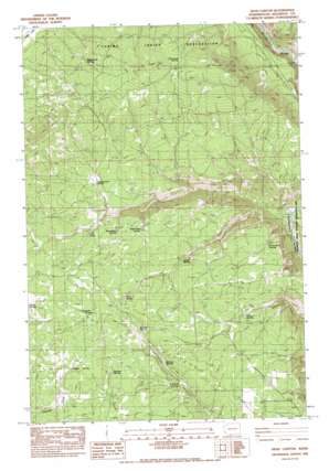
Dead Canyon Topo Map Washington
To zoom in, hover over the map of Dead Canyon
USGS Topo Quad 45121h2 - 1:24,000 scale
| Topo Map Name: | Dead Canyon |
| USGS Topo Quad ID: | 45121h2 |
| Print Size: | ca. 21 1/4" wide x 27" high |
| Southeast Coordinates: | 45.875° N latitude / 121.125° W longitude |
| Map Center Coordinates: | 45.9375° N latitude / 121.1875° W longitude |
| U.S. State: | WA |
| Filename: | o45121h2.jpg |
| Download Map JPG Image: | Dead Canyon topo map 1:24,000 scale |
| Map Type: | Topographic |
| Topo Series: | 7.5´ |
| Map Scale: | 1:24,000 |
| Source of Map Images: | United States Geological Survey (USGS) |
| Alternate Map Versions: |
Dead Canyon WA 1983, updated 1983 Download PDF Buy paper map Dead Canyon WA 2011 Download PDF Buy paper map Dead Canyon WA 2014 Download PDF Buy paper map |
1:24,000 Topo Quads surrounding Dead Canyon
> Back to 45121e1 at 1:100,000 scale
> Back to 45120a1 at 1:250,000 scale
> Back to U.S. Topo Maps home
Dead Canyon topo map: Gazetteer
Dead Canyon: Lakes
Fill Pond elevation 635m 2083′Dead Canyon: Plains
The Plateau elevation 756m 2480′Dead Canyon: Springs
Boulder Spring elevation 576m 1889′Camp Five Spring elevation 653m 2142′
Camp Six Spring elevation 687m 2253′
Cottonwood Spring elevation 841m 2759′
Gates Spring elevation 609m 1998′
Gregory Spring elevation 716m 2349′
Harmon Spring elevation 746m 2447′
Hathaway Spring elevation 622m 2040′
Kuhnhausen Spring elevation 642m 2106′
Ladies Spring elevation 655m 2148′
Legall Spring elevation 734m 2408′
Masondale Spring elevation 647m 2122′
Murray Spring elevation 687m 2253′
Myting Spring elevation 710m 2329′
Paradise Spring elevation 717m 2352′
Pennington Spring elevation 612m 2007′
Rock Springs elevation 847m 2778′
Spoon Spring elevation 625m 2050′
Wellenbrock Spring elevation 707m 2319′
Dead Canyon: Valleys
Dead Canyon elevation 301m 987′Willis Canyon elevation 294m 964′
Dead Canyon digital topo map on disk
Buy this Dead Canyon topo map showing relief, roads, GPS coordinates and other geographical features, as a high-resolution digital map file on DVD:


