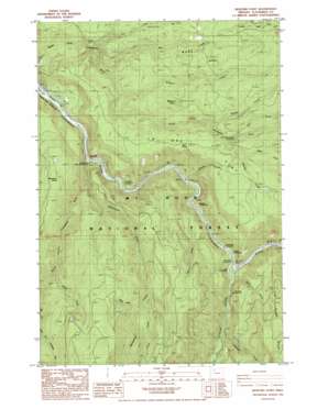
Bedford Point Topo Map Oregon
To zoom in, hover over the map of Bedford Point
USGS Topo Quad 45122b2 - 1:24,000 scale
| Topo Map Name: | Bedford Point |
| USGS Topo Quad ID: | 45122b2 |
| Print Size: | ca. 21 1/4" wide x 27" high |
| Southeast Coordinates: | 45.125° N latitude / 122.125° W longitude |
| Map Center Coordinates: | 45.1875° N latitude / 122.1875° W longitude |
| U.S. State: | OR |
| Filename: | o45122b2.jpg |
| Download Map JPG Image: | Bedford Point topo map 1:24,000 scale |
| Map Type: | Topographic |
| Topo Series: | 7.5´ |
| Map Scale: | 1:24,000 |
| Source of Map Images: | United States Geological Survey (USGS) |
| Alternate Map Versions: |
Bedford Point OR 1986, updated 1986 Download PDF Buy paper map Bedford Point OR 1997, updated 1999 Download PDF Buy paper map Bedford Point OR 2011 Download PDF Buy paper map Bedford Point OR 2014 Download PDF Buy paper map |
| FStopo: | US Forest Service topo Bedford Point is available: Download FStopo PDF Download FStopo TIF |
1:24,000 Topo Quads surrounding Bedford Point
> Back to 45122a1 at 1:100,000 scale
> Back to 45122a1 at 1:250,000 scale
> Back to U.S. Topo Maps home
Bedford Point topo map: Gazetteer
Bedford Point: Cliffs
Big Cliff elevation 289m 948′Bedford Point: Flats
La Dee Flat elevation 700m 2296′Bedford Point: Lakes
Small Fry Lake elevation 293m 961′Bedford Point: Ridges
Mongrel Ridge elevation 1068m 3503′Bedford Point: Springs
Cold Spring elevation 667m 2188′Hillockburn Spring elevation 683m 2240′
Bedford Point: Streams
Bedford Creek elevation 425m 1394′Bee Creek elevation 341m 1118′
Boyer Creek elevation 660m 2165′
Cultus Creek elevation 800m 2624′
Dog Creek elevation 270m 885′
Dry Creek elevation 609m 1998′
Fall Creek elevation 304m 997′
Fish Creek elevation 272m 892′
Helion Creek elevation 253m 830′
Memaloose Creek elevation 266m 872′
Moore Creek elevation 241m 790′
Murphy Creek elevation 292m 958′
Oscar Creek elevation 513m 1683′
Rimrock Creek elevation 319m 1046′
South Fork Clackamas River elevation 206m 675′
Whisky Creek elevation 598m 1961′
Winslow Creek elevation 660m 2165′
Bedford Point: Summits
Bedford Point elevation 714m 2342′Bedford Point: Trails
Memaloose Trail elevation 846m 2775′Wanderers Peak Trail elevation 985m 3231′
Bedford Point digital topo map on disk
Buy this Bedford Point topo map showing relief, roads, GPS coordinates and other geographical features, as a high-resolution digital map file on DVD:


