Salmon Topo Map Oregon
To zoom in, hover over the map of Salmon
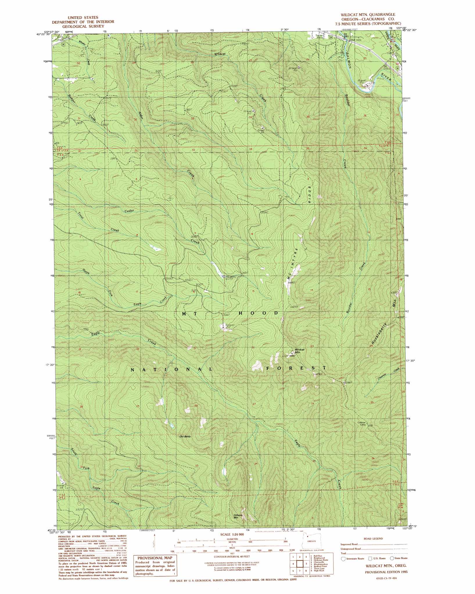
USGS Topo Quad 45122c1 - 1:24,000 scale
| Topo Map Name: | Salmon |
| USGS Topo Quad ID: | 45122c1 |
| Print Size: | ca. 21 1/4" wide x 27" high |
| Southeast Coordinates: | 45.25° N latitude / 122° W longitude |
| Map Center Coordinates: | 45.3125° N latitude / 122.0625° W longitude |
| U.S. State: | OR |
| Filename: | o45122c1.jpg |
| Download Map JPG Image: | Salmon topo map 1:24,000 scale |
| Map Type: | Topographic |
| Topo Series: | 7.5´ |
| Map Scale: | 1:24,000 |
| Source of Map Images: | United States Geological Survey (USGS) |
| Alternate Map Versions: |
Wildcat Mountain OR 1985, updated 1986 Download PDF Buy paper map Wildcat Mountain OR 1997, updated 1999 Download PDF Buy paper map Wildcat Mountain OR 2011 Download PDF Buy paper map Wildcat Mountain OR 2014 Download PDF Buy paper map |
| FStopo: | US Forest Service topo Wildcat Mountain is available: Download FStopo PDF Download FStopo TIF |
1:24,000 Topo Quads surrounding Salmon
Washougal |
Bridal Veil |
Multnomah Falls |
Tanner Butte |
Wahtum Lake |
Sandy |
Bull Run |
Brightwood |
Hickman Butte |
Bull Run Lake |
Estacada |
Cherryville |
Salmon |
Rhododendron |
Government Camp |
Elwood |
Bedford Point |
Three Lynx |
High Rock |
Wolf Peak |
Soosap Peak |
Wanderers Peak |
Fish Creek Mountain |
Mount Mitchell |
Timothy Lake |
> Back to 45122a1 at 1:100,000 scale
> Back to 45122a1 at 1:250,000 scale
> Back to U.S. Topo Maps home
Salmon topo map: Gazetteer
Salmon: Post Offices
Salmon Post Office (historical) elevation 347m 1138′Salmon: Ridges
McIntyre Ridge elevation 1284m 4212′Salmon: Streams
Boulder Creek elevation 321m 1053′Salmon: Summits
Githens Mountain elevation 1368m 4488′Huckleberry Mountain elevation 1301m 4268′
Old Baldy elevation 1274m 4179′
Wildcat Mountain elevation 1358m 4455′
Salmon: Trails
Eagle Creek Cutoff elevation 1054m 3458′Old Baldy Trail elevation 1297m 4255′
Plaza Trail elevation 1156m 3792′
Salmon digital topo map on disk
Buy this Salmon topo map showing relief, roads, GPS coordinates and other geographical features, as a high-resolution digital map file on DVD: