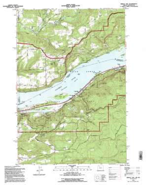
Bridal Veil Topo Map Oregon
To zoom in, hover over the map of Bridal Veil
USGS Topo Quad 45122e2 - 1:24,000 scale
| Topo Map Name: | Bridal Veil |
| USGS Topo Quad ID: | 45122e2 |
| Print Size: | ca. 21 1/4" wide x 27" high |
| Southeast Coordinates: | 45.5° N latitude / 122.125° W longitude |
| Map Center Coordinates: | 45.5625° N latitude / 122.1875° W longitude |
| U.S. States: | OR, WA |
| Filename: | o45122e2.jpg |
| Download Map JPG Image: | Bridal Veil topo map 1:24,000 scale |
| Map Type: | Topographic |
| Topo Series: | 7.5´ |
| Map Scale: | 1:24,000 |
| Source of Map Images: | United States Geological Survey (USGS) |
| Alternate Map Versions: |
Bridal Veil OR 1986, updated 1986 Download PDF Buy paper map Bridal Veil OR 1986, updated 1994 Download PDF Buy paper map Bridal Veil OR 1994, updated 1996 Download PDF Buy paper map Bridal Veil OR 2011 Download PDF Buy paper map Bridal Veil OR 2014 Download PDF Buy paper map |
| FStopo: | US Forest Service topo Bridal Veil is available: Download FStopo PDF Download FStopo TIF |
1:24,000 Topo Quads surrounding Bridal Veil
> Back to 45122e1 at 1:100,000 scale
> Back to 45122a1 at 1:250,000 scale
> Back to U.S. Topo Maps home
Bridal Veil topo map: Gazetteer
Bridal Veil: Bars
Fashion Reef elevation 6m 19′Bridal Veil: Capes
Dalton Point elevation 9m 29′Fir Point elevation 11m 36′
Bridal Veil: Channels
Broughton Reach elevation 6m 19′Candiana Channel elevation 6m 19′
Cape Horn Channel elevation 49m 160′
Fashion Reef Lower Range elevation 6m 19′
Bridal Veil: Cliffs
Cape Horn elevation 85m 278′Bridal Veil: Dams
Julian Dam elevation 249m 816′Bridal Veil: Falls
Bridal Veil Falls elevation 41m 134′Coopey Falls elevation 83m 272′
Latourell Falls elevation 132m 433′
Mist Falls elevation 318m 1043′
Upper Latourell Falls elevation 237m 777′
Wahkeena Falls elevation 271m 889′
Bridal Veil: Flats
Fletcher Flat elevation 481m 1578′Bridal Veil: Islands
Phoca Rock elevation 6m 19′Sand Island elevation 27m 88′
Bridal Veil: Parks
Benson State Park elevation 14m 45′Bridal Veil Falls State Park elevation 30m 98′
Dalton Point State Recreation Site elevation 11m 36′
George W Joseph State Park elevation 226m 741′
Guy W Talbot State Park elevation 207m 679′
Larch Mountain Corridor elevation 488m 1601′
Rooster Rock State Park elevation 23m 75′
Shepperds Dell State Park elevation 86m 282′
Bridal Veil: Pillars
Pillars of Hercules elevation 14m 45′Bridal Veil: Populated Places
Bridal Veil elevation 35m 114′Cruzatt elevation 54m 177′
Latourell elevation 29m 95′
Molfait Tracts elevation 109m 357′
Prindle elevation 6m 19′
Bridal Veil: Post Offices
Bridal Veil Post Office elevation 35m 114′Brower Post Office (historical) elevation 529m 1735′
Latourell Falls Post Office (historical) elevation 29m 95′
Palmer Post Office (historical) elevation 690m 2263′
Bridal Veil: Reservoirs
Wahkeena Rearing Lake elevation 10m 32′Bridal Veil: Springs
Schoolhouse Spring elevation 515m 1689′Bridal Veil: Streams
Bridal Veil Creek elevation 6m 19′Canyon Creek elevation 98m 321′
Coopey Creek elevation 6m 19′
Dalton Creek elevation 567m 1860′
Donahue Creek elevation 422m 1384′
Henderson Creek elevation 420m 1377′
Latourell Creek elevation 13m 42′
South Fork Gordon Creek elevation 552m 1811′
Vogel Creek elevation 150m 492′
Wahkeena Creek elevation 6m 19′
West Fork Washougal River elevation 110m 360′
Young Creek elevation 6m 19′
Bridal Veil: Summits
Angels Rest elevation 400m 1312′Biddle Butte elevation 424m 1391′
Crown Point elevation 225m 738′
Devils Rest elevation 730m 2395′
Mount Pleasant elevation 301m 987′
Pepper Mountain elevation 656m 2152′
Ross Mountain elevation 396m 1299′
Bridal Veil: Valleys
Shepperds Dell elevation 40m 131′Bridal Veil digital topo map on disk
Buy this Bridal Veil topo map showing relief, roads, GPS coordinates and other geographical features, as a high-resolution digital map file on DVD:


