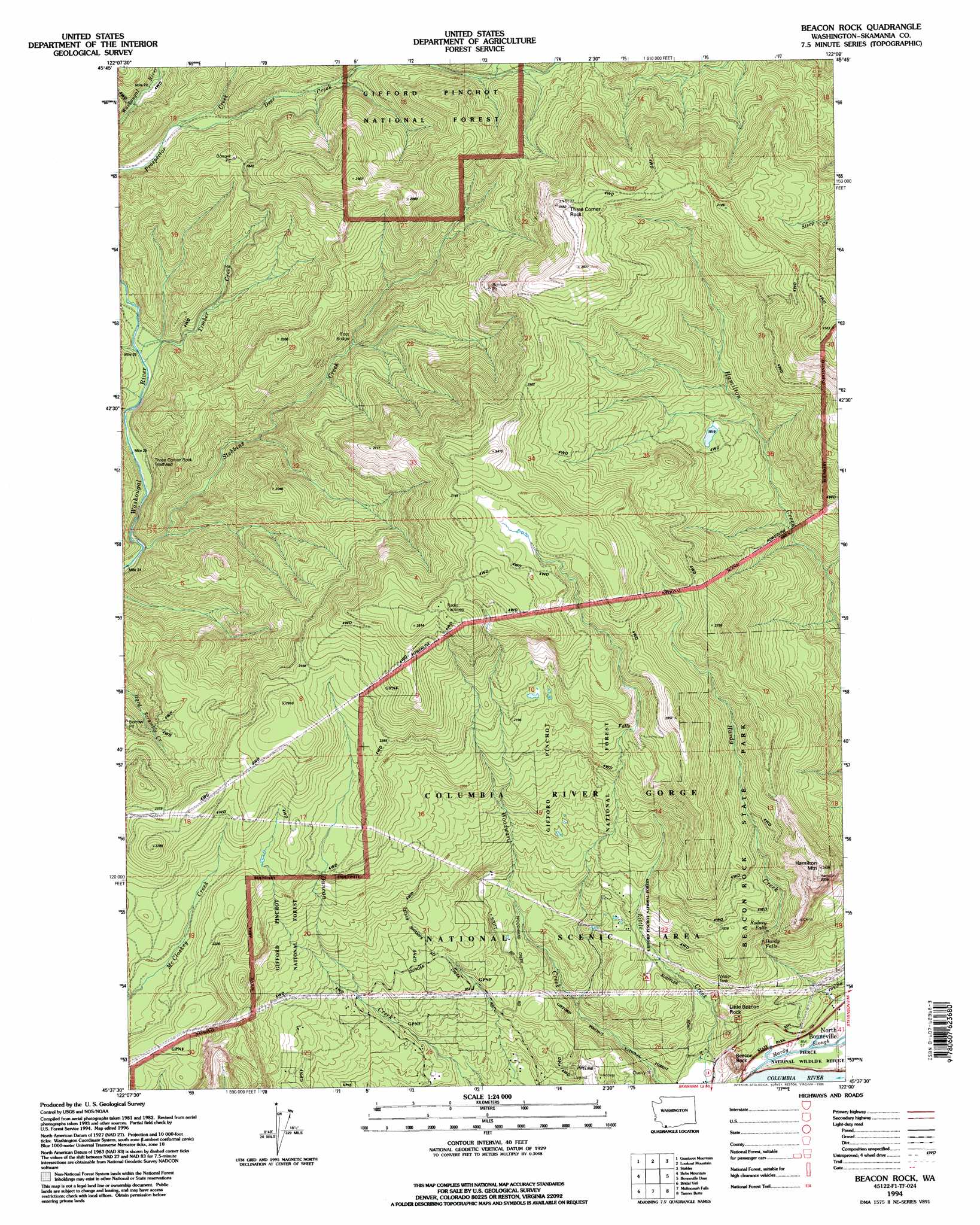
Beacon Rock Topo Map Washington
To zoom in, hover over the map of Beacon Rock
USGS Topo Quad 45122f1 - 1:24,000 scale
| Topo Map Name: | Beacon Rock |
| USGS Topo Quad ID: | 45122f1 |
| Print Size: | ca. 21 1/4" wide x 27" high |
| Southeast Coordinates: | 45.625° N latitude / 122° W longitude |
| Map Center Coordinates: | 45.6875° N latitude / 122.0625° W longitude |
| U.S. State: | WA |
| Filename: | o45122f1.jpg |
| Download Map JPG Image: | Beacon Rock topo map 1:24,000 scale |
| Map Type: | Topographic |
| Topo Series: | 7.5´ |
| Map Scale: | 1:24,000 |
| Source of Map Images: | United States Geological Survey (USGS) |
| Alternate Map Versions: |
Beacon Rock WA 1986, updated 1986 Download PDF Buy paper map Beacon Rock WA 1986, updated 1994 Download PDF Buy paper map Beacon Rock WA 1994, updated 1996 Download PDF Buy paper map Beacon Rock WA 2011 Download PDF Buy paper map Beacon Rock WA 2013 Download PDF Buy paper map |
| FStopo: | US Forest Service topo Beacon Rock is available: Download FStopo PDF Download FStopo TIF |
1:24,000 Topo Quads surrounding Beacon Rock
Yale Dam |
Siouxon Peak |
Bare Mountain |
Termination Point |
Gifford Peak |
Dole |
Gumboot Mountain |
Lookout Mountain |
Stabler |
Big Huckleberry Mountain |
Larch Mountain |
Bobs Mountain |
Beacon Rock |
Bonneville Dam |
Carson |
Washougal |
Bridal Veil |
Multnomah Falls |
Tanner Butte |
Wahtum Lake |
Sandy |
Bull Run |
Brightwood |
Hickman Butte |
Bull Run Lake |
> Back to 45122e1 at 1:100,000 scale
> Back to 45122a1 at 1:250,000 scale
> Back to U.S. Topo Maps home
Beacon Rock topo map: Gazetteer
Beacon Rock: Dams
B and W Pond Dam Number One elevation 419m 1374′B and W Pond Dam Number Three elevation 360m 1181′
Beacon Rock: Falls
Hardy Falls elevation 263m 862′Rodney Falls elevation 313m 1026′
Beacon Rock: Parks
Beacon Rock State Park elevation 601m 1971′Beacon Rock: Pillars
Beacon Rock elevation 243m 797′Little Beacon Rock elevation 215m 705′
Three Corner Rock elevation 1059m 3474′
Beacon Rock: Streams
Deer Creek elevation 413m 1354′Stebbins Creek elevation 259m 849′
Timber Creek elevation 279m 915′
Beacon Rock: Summits
Hamilton Mountain elevation 729m 2391′Beacon Rock digital topo map on disk
Buy this Beacon Rock topo map showing relief, roads, GPS coordinates and other geographical features, as a high-resolution digital map file on DVD: