Bobs Mountain Topo Map Washington
To zoom in, hover over the map of Bobs Mountain
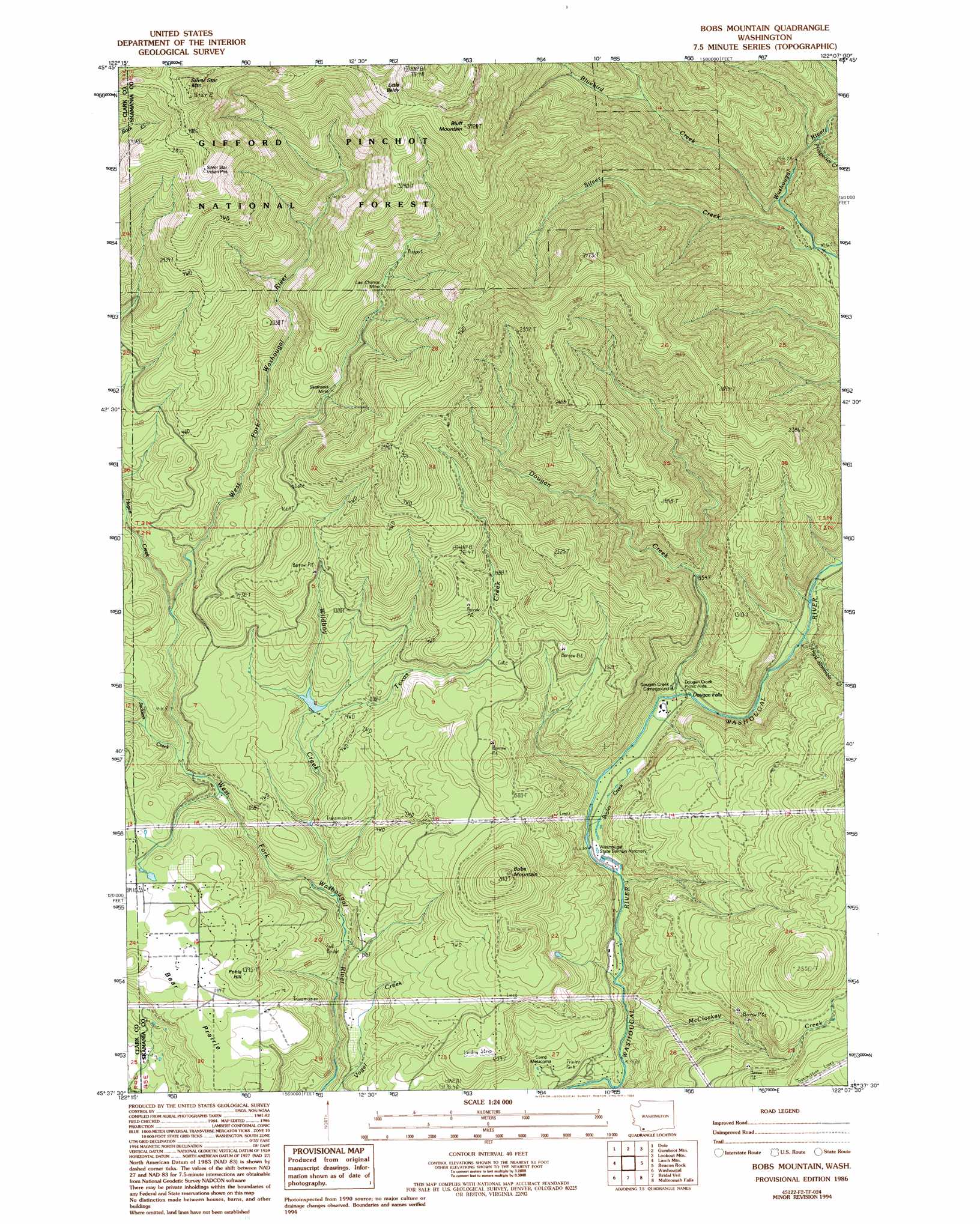
USGS Topo Quad 45122f2 - 1:24,000 scale
| Topo Map Name: | Bobs Mountain |
| USGS Topo Quad ID: | 45122f2 |
| Print Size: | ca. 21 1/4" wide x 27" high |
| Southeast Coordinates: | 45.625° N latitude / 122.125° W longitude |
| Map Center Coordinates: | 45.6875° N latitude / 122.1875° W longitude |
| U.S. State: | WA |
| Filename: | o45122f2.jpg |
| Download Map JPG Image: | Bobs Mountain topo map 1:24,000 scale |
| Map Type: | Topographic |
| Topo Series: | 7.5´ |
| Map Scale: | 1:24,000 |
| Source of Map Images: | United States Geological Survey (USGS) |
| Alternate Map Versions: |
Bobs Mountain WA 1986, updated 1986 Download PDF Buy paper map Bobs Mountain WA 1986, updated 1994 Download PDF Buy paper map Bobs Mountain WA 2000, updated 2003 Download PDF Buy paper map Bobs Mountain WA 2011 Download PDF Buy paper map Bobs Mountain WA 2013 Download PDF Buy paper map |
| FStopo: | US Forest Service topo Bobs Mountain is available: Download FStopo PDF Download FStopo TIF |
1:24,000 Topo Quads surrounding Bobs Mountain
Amboy |
Yale Dam |
Siouxon Peak |
Bare Mountain |
Termination Point |
Yacolt |
Dole |
Gumboot Mountain |
Lookout Mountain |
Stabler |
Lacamas Creek |
Larch Mountain |
Bobs Mountain |
Beacon Rock |
Bonneville Dam |
Camas |
Washougal |
Bridal Veil |
Multnomah Falls |
Tanner Butte |
Damascus |
Sandy |
Bull Run |
Brightwood |
Hickman Butte |
> Back to 45122e1 at 1:100,000 scale
> Back to 45122a1 at 1:250,000 scale
> Back to U.S. Topo Maps home
Bobs Mountain topo map: Gazetteer
Bobs Mountain: Dams
Caldwell Dam elevation 343m 1125′Camp Kwoneesum Dam elevation 284m 931′
Bobs Mountain: Falls
Dougan Falls elevation 196m 643′Bobs Mountain: Flats
Bear Prairie elevation 338m 1108′Bobs Mountain: Lakes
Washougal Ponds elevation 190m 623′Bobs Mountain: Mines
Last Chance Mine elevation 592m 1942′Skamania Mine elevation 496m 1627′
Bobs Mountain: Streams
Bluebird Creek elevation 314m 1030′Boyles Creek elevation 184m 603′
Dougan Creek elevation 216m 708′
Hagen Creek elevation 315m 1033′
Hard Scramble Creek elevation 218m 715′
Jackson Creek elevation 258m 846′
McCloskey Creek elevation 158m 518′
Prospector Creek elevation 373m 1223′
Silver Creek elevation 303m 994′
Texas Creek elevation 245m 803′
Wildboy Creek elevation 182m 597′
Bobs Mountain: Summits
Bluff Mountain elevation 1155m 3789′Bobs Mountain elevation 634m 2080′
Little Baldy elevation 1164m 3818′
Pohls Hill elevation 410m 1345′
Silver Star Mountain elevation 1335m 4379′
Sturgeon Rock elevation 1267m 4156′
Bobs Mountain digital topo map on disk
Buy this Bobs Mountain topo map showing relief, roads, GPS coordinates and other geographical features, as a high-resolution digital map file on DVD: