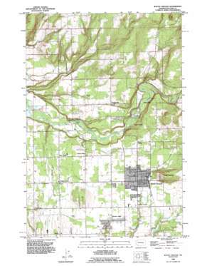
Battle Ground Topo Map Washington
To zoom in, hover over the map of Battle Ground
USGS Topo Quad 45122g5 - 1:24,000 scale
| Topo Map Name: | Battle Ground |
| USGS Topo Quad ID: | 45122g5 |
| Print Size: | ca. 21 1/4" wide x 27" high |
| Southeast Coordinates: | 45.75° N latitude / 122.5° W longitude |
| Map Center Coordinates: | 45.8125° N latitude / 122.5625° W longitude |
| U.S. State: | WA |
| Filename: | o45122g5.jpg |
| Download Map JPG Image: | Battle Ground topo map 1:24,000 scale |
| Map Type: | Topographic |
| Topo Series: | 7.5´ |
| Map Scale: | 1:24,000 |
| Source of Map Images: | United States Geological Survey (USGS) |
| Alternate Map Versions: |
Battle Ground WA 1954, updated 1955 Download PDF Buy paper map Battle Ground WA 1954, updated 1971 Download PDF Buy paper map Battle Ground WA 1954, updated 1977 Download PDF Buy paper map Battle Ground WA 1990, updated 1995 Download PDF Buy paper map Battle Ground WA 2011 Download PDF Buy paper map Battle Ground WA 2013 Download PDF Buy paper map |
1:24,000 Topo Quads surrounding Battle Ground
> Back to 45122e1 at 1:100,000 scale
> Back to 45122a1 at 1:250,000 scale
> Back to U.S. Topo Maps home
Battle Ground topo map: Gazetteer
Battle Ground: Airports
Goheen Airport elevation 84m 275′Parkside Airport elevation 83m 272′
Battle Ground: Dams
Harden Reservoir Dam elevation 186m 610′Battle Ground: Populated Places
Battle Ground elevation 90m 295′Battle Ground West elevation 89m 291′
Charter Oak elevation 104m 341′
Cherry Grove elevation 83m 272′
Dollar Corner elevation 67m 219′
Good Hope elevation 78m 255′
King Corner elevation 71m 232′
Kumtux elevation 94m 308′
Lewisville elevation 126m 413′
Meadow Glade elevation 86m 282′
Scotton Corner elevation 84m 275′
Battle Ground: Post Offices
Battle Ground Post Office elevation 89m 291′Battle Ground: Reservoirs
Harden Reservoir elevation 186m 610′Battle Ground: Streams
Morgan Creek elevation 75m 246′Rock Creek elevation 63m 206′
Battle Ground: Summits
Tukes Mountain elevation 181m 593′Battle Ground digital topo map on disk
Buy this Battle Ground topo map showing relief, roads, GPS coordinates and other geographical features, as a high-resolution digital map file on DVD:


