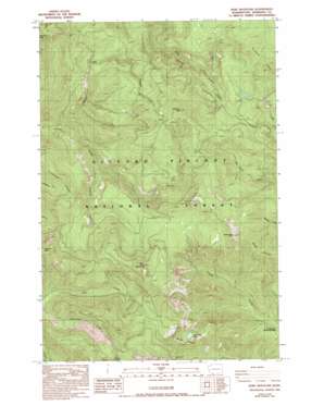
Bare Mountain Topo Map Washington
To zoom in, hover over the map of Bare Mountain
USGS Topo Quad 45122h1 - 1:24,000 scale
| Topo Map Name: | Bare Mountain |
| USGS Topo Quad ID: | 45122h1 |
| Print Size: | ca. 21 1/4" wide x 27" high |
| Southeast Coordinates: | 45.875° N latitude / 122° W longitude |
| Map Center Coordinates: | 45.9375° N latitude / 122.0625° W longitude |
| U.S. State: | WA |
| Filename: | o45122h1.jpg |
| Download Map JPG Image: | Bare Mountain topo map 1:24,000 scale |
| Map Type: | Topographic |
| Topo Series: | 7.5´ |
| Map Scale: | 1:24,000 |
| Source of Map Images: | United States Geological Survey (USGS) |
| Alternate Map Versions: |
Bare Mountain WA 1986, updated 1986 Download PDF Buy paper map Bare Mountain WA 1986, updated 1993 Download PDF Buy paper map Bare Mountain WA 1998, updated 2003 Download PDF Buy paper map Bare Mountain WA 2011 Download PDF Buy paper map Bare Mountain WA 2013 Download PDF Buy paper map |
| FStopo: | US Forest Service topo Bare Mountain is available: Download FStopo PDF Download FStopo TIF |
1:24,000 Topo Quads surrounding Bare Mountain
> Back to 45122e1 at 1:100,000 scale
> Back to 45122a1 at 1:250,000 scale
> Back to U.S. Topo Maps home
Bare Mountain topo map: Gazetteer
Bare Mountain: Lakes
Soda Peaks Lake elevation 1155m 3789′Bare Mountain: Parks
Sister Rocks Research Natural Area elevation 1207m 3959′Bare Mountain: Ridges
Horseshoe Ridge elevation 1052m 3451′Bare Mountain: Streams
Calamity Creek elevation 600m 1968′Chinook Creek elevation 469m 1538′
Puny Creek elevation 628m 2060′
Timber Creek elevation 657m 2155′
Bare Mountain: Summits
Bare Mountain elevation 1264m 4146′Observation Peak elevation 1250m 4101′
Sister Rocks elevation 1263m 4143′
Soda Peaks elevation 1351m 4432′
Timbered Peak elevation 1297m 4255′
Bare Mountain: Trails
Calamity Peak Trail elevation 1172m 3845′Observation Peak Trail elevation 864m 2834′
Ridge Trail elevation 1186m 3891′
Bare Mountain: Valleys
Paradise Valley elevation 880m 2887′Bare Mountain digital topo map on disk
Buy this Bare Mountain topo map showing relief, roads, GPS coordinates and other geographical features, as a high-resolution digital map file on DVD:


