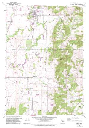
Amity Topo Map Oregon
To zoom in, hover over the map of Amity
USGS Topo Quad 45123a2 - 1:24,000 scale
| Topo Map Name: | Amity |
| USGS Topo Quad ID: | 45123a2 |
| Print Size: | ca. 21 1/4" wide x 27" high |
| Southeast Coordinates: | 45° N latitude / 123.125° W longitude |
| Map Center Coordinates: | 45.0625° N latitude / 123.1875° W longitude |
| U.S. State: | OR |
| Filename: | o45123a2.jpg |
| Download Map JPG Image: | Amity topo map 1:24,000 scale |
| Map Type: | Topographic |
| Topo Series: | 7.5´ |
| Map Scale: | 1:24,000 |
| Source of Map Images: | United States Geological Survey (USGS) |
| Alternate Map Versions: |
Amity OR 1957, updated 1958 Download PDF Buy paper map Amity OR 1957, updated 1971 Download PDF Buy paper map Amity OR 1957, updated 1993 Download PDF Buy paper map Amity OR 2011 Download PDF Buy paper map Amity OR 2014 Download PDF Buy paper map |
1:24,000 Topo Quads surrounding Amity
> Back to 45123a1 at 1:100,000 scale
> Back to 45122a1 at 1:250,000 scale
> Back to U.S. Topo Maps home
Amity topo map: Gazetteer
Amity: Airports
Wilson Airfield elevation 57m 187′Amity: Dams
Martin Brothers Flashboard Dam elevation 51m 167′Marvin Fast Dam elevation 49m 160′
Phil Olson Dam elevation 43m 141′
Rohde Dam elevation 51m 167′
Amity: Lakes
Solle Ponds elevation 143m 469′Amity: Populated Places
Amity elevation 50m 164′Bethel elevation 60m 196′
Bethel Heights elevation 232m 761′
Eola Crest elevation 264m 866′
McCoy elevation 51m 167′
Zena elevation 88m 288′
Amity: Post Offices
Amity Post Office elevation 50m 164′Bethel Post Office (historical) elevation 60m 196′
Briedwell Post Office (historical) elevation 50m 164′
McCoy Post Office (historical) elevation 51m 167′
Zena Post Office (historical) elevation 88m 288′
Amity: Reservoirs
Anderson Reservoir elevation 37m 121′Bowles Reservoir elevation 73m 239′
Brydon Reservoir elevation 82m 269′
Feldman Reservoir elevation 215m 705′
Four H Reservoir elevation 185m 606′
Kraitz Reservoir elevation 43m 141′
Maple Mound Reservoir elevation 73m 239′
Markee Reservoir elevation 49m 160′
Martin Brothers Flashboard Reservoir elevation 51m 167′
Martin Reservoir elevation 50m 164′
Marvin Fast Reservoir elevation 49m 160′
Phil Olson Reservoir elevation 43m 141′
Robinson Reservoir elevation 42m 137′
Rohde Reservoir elevation 51m 167′
Stewart Reservoir elevation 56m 183′
Wilson Reservoir elevation 52m 170′
Amity: Springs
Larson Spring elevation 272m 892′Mathew Spring elevation 253m 830′
Zimmerman Spring elevation 157m 515′
Amity: Streams
Ash Swale elevation 36m 118′Athey Creek elevation 43m 141′
West Branch Ash Swale elevation 50m 164′
Amity: Summits
Crescent Hill elevation 67m 219′Amity: Valleys
Athey Canyon elevation 84m 275′Plum Valley elevation 59m 193′
Amity digital topo map on disk
Buy this Amity topo map showing relief, roads, GPS coordinates and other geographical features, as a high-resolution digital map file on DVD:


