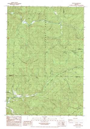
Dolph Topo Map Oregon
To zoom in, hover over the map of Dolph
USGS Topo Quad 45123a7 - 1:24,000 scale
| Topo Map Name: | Dolph |
| USGS Topo Quad ID: | 45123a7 |
| Print Size: | ca. 21 1/4" wide x 27" high |
| Southeast Coordinates: | 45° N latitude / 123.75° W longitude |
| Map Center Coordinates: | 45.0625° N latitude / 123.8125° W longitude |
| U.S. State: | OR |
| Filename: | o45123a7.jpg |
| Download Map JPG Image: | Dolph topo map 1:24,000 scale |
| Map Type: | Topographic |
| Topo Series: | 7.5´ |
| Map Scale: | 1:24,000 |
| Source of Map Images: | United States Geological Survey (USGS) |
| Alternate Map Versions: |
Dolph OR 1985, updated 1985 Download PDF Buy paper map Dolph OR 2011 Download PDF Buy paper map Dolph OR 2014 Download PDF Buy paper map |
| FStopo: | US Forest Service topo Dolph is available: Download FStopo PDF Download FStopo TIF |
1:24,000 Topo Quads surrounding Dolph
> Back to 45123a1 at 1:100,000 scale
> Back to 45122a1 at 1:250,000 scale
> Back to U.S. Topo Maps home
Dolph topo map: Gazetteer
Dolph: Bridges
Muscott Bridge elevation 101m 331′Weed Bridge elevation 135m 442′
Yach Bridge elevation 56m 183′
Dolph: Falls
Gunaldo Falls elevation 176m 577′Dolph: Parks
H B Van Duzer Forest State Scenic Corridor elevation 135m 442′Dolph: Post Offices
Boyer Post Office (historical) elevation 129m 423′Dolph Post Office (historical) elevation 135m 442′
Pitner Post Office (historical) elevation 173m 567′
Dolph: Ridges
Neskowin Ridge elevation 474m 1555′Dolph: Streams
Alder Brook elevation 64m 209′Baxter Creek elevation 153m 501′
Bear Creek elevation 176m 577′
Bear Creek elevation 82m 269′
Boulder Creek elevation 166m 544′
Cedar Creek elevation 129m 423′
Conklin Creek elevation 144m 472′
Deer Creek elevation 94m 308′
Fall Creek elevation 172m 564′
Hiack Creek elevation 147m 482′
Indian Creek elevation 135m 442′
Judson Creek elevation 109m 357′
Kautz Creek elevation 148m 485′
Little Creek elevation 65m 213′
Little Salmon River elevation 151m 495′
Louie Creek elevation 155m 508′
McAllister Creek elevation 90m 295′
McKnight Creek elevation 95m 311′
Muscott Creek elevation 139m 456′
Prairie Creek elevation 123m 403′
Small Creek elevation 116m 380′
Sourgrass Creek elevation 132m 433′
South Fork Little Nestucca River elevation 95m 311′
Stillwell Creek elevation 153m 501′
Sulphur Creek elevation 122m 400′
Swampy Creek elevation 93m 305′
Treat River elevation 71m 232′
Trout Creek elevation 85m 278′
West Fork Salmon River elevation 62m 203′
Widow Creek elevation 75m 246′
Dolph digital topo map on disk
Buy this Dolph topo map showing relief, roads, GPS coordinates and other geographical features, as a high-resolution digital map file on DVD:


