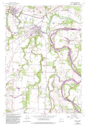
Dayton Topo Map Oregon
To zoom in, hover over the map of Dayton
USGS Topo Quad 45123b1 - 1:24,000 scale
| Topo Map Name: | Dayton |
| USGS Topo Quad ID: | 45123b1 |
| Print Size: | ca. 21 1/4" wide x 27" high |
| Southeast Coordinates: | 45.125° N latitude / 123° W longitude |
| Map Center Coordinates: | 45.1875° N latitude / 123.0625° W longitude |
| U.S. State: | OR |
| Filename: | o45123b1.jpg |
| Download Map JPG Image: | Dayton topo map 1:24,000 scale |
| Map Type: | Topographic |
| Topo Series: | 7.5´ |
| Map Scale: | 1:24,000 |
| Source of Map Images: | United States Geological Survey (USGS) |
| Alternate Map Versions: |
Dayton OR 1957, updated 1959 Download PDF Buy paper map Dayton OR 1957, updated 1972 Download PDF Buy paper map Dayton OR 1957, updated 1978 Download PDF Buy paper map Dayton OR 1957, updated 1993 Download PDF Buy paper map Dayton OR 2011 Download PDF Buy paper map Dayton OR 2014 Download PDF Buy paper map |
1:24,000 Topo Quads surrounding Dayton
> Back to 45123a1 at 1:100,000 scale
> Back to 45122a1 at 1:250,000 scale
> Back to U.S. Topo Maps home
Dayton topo map: Gazetteer
Dayton: Bars
Allison Bar elevation 28m 91′Brentano Bar elevation 29m 95′
Candiani Bar elevation 24m 78′
Coffee Island Bar elevation 23m 75′
Duke Bar elevation 26m 85′
Fairfield Bar elevation 54m 177′
Feasters Rocks elevation 31m 101′
Five Islands Bar elevation 23m 75′
Lower Lambert Bar elevation 24m 78′
Mission Bar elevation 23m 75′
Snaggy Bend Bar elevation 29m 95′
Upper Lambert Bar elevation 25m 82′
Weston Bar elevation 23m 75′
Dayton: Beaches
San Salvador Beach elevation 24m 78′Dayton: Bends
Carey Bend elevation 21m 68′Jackson Bend elevation 25m 82′
Lambert Bend elevation 26m 85′
Weston Bend elevation 25m 82′
Dayton: Channels
Coffee Chute elevation 23m 75′Dayton: Dams
Cole and Forrester Dam elevation 42m 137′Stringer Dam elevation 43m 141′
Dayton: Islands
Coffee Island elevation 23m 75′Five Islands elevation 25m 82′
Grand Island elevation 32m 104′
Dayton: Lakes
Connor Lake elevation 26m 85′Evers Lake elevation 27m 88′
Meadowbrook Lake elevation 29m 95′
Scottys Pond elevation 61m 200′
Dayton: Parks
11th Street Park elevation 51m 167′Alden Park elevation 24m 78′
Alderman Park elevation 32m 104′
Commons Park elevation 51m 167′
Courthouse Square Park elevation 48m 157′
Dayton Boat Landing elevation 31m 101′
Dayton Landing County Park elevation 29m 95′
Fort Yamhill State Park elevation 48m 157′
Joel Perkins Park elevation 57m 187′
Lafayette Locks County Park elevation 25m 82′
Legion Field elevation 41m 134′
San Salvador Access elevation 22m 72′
Terry Park elevation 40m 131′
Dayton: Populated Places
Dayton elevation 48m 157′Fairfield elevation 50m 164′
Lafayette elevation 52m 170′
Unionvale elevation 52m 170′
Dayton: Post Offices
Crawford Post Office (historical) elevation 57m 187′Dayton Post Office elevation 48m 157′
Fairfield Post Office (historical) elevation 50m 164′
Lafayette Post Office elevation 52m 170′
Mount Hood Post Office (historical) elevation 58m 190′
Saint Clair Post Office (historical) elevation 27m 88′
Willamette Post Office (historical) elevation 31m 101′
Dayton: Reservoirs
Horseshoe Lake elevation 22m 72′Kunz Reservoir elevation 51m 167′
Michael Reservoir elevation 32m 104′
Schuetze Reservoir elevation 42m 137′
Stinger Reservoir elevation 43m 141′
Stockhoff Reservoir elevation 41m 134′
Stringer Reservoir elevation 43m 141′
Woods Reservoir elevation 45m 147′
Dayton: Streams
Hawn Creek elevation 25m 82′Henry Creek elevation 22m 72′
Holdridge Creek elevation 38m 124′
Lambert Slough elevation 24m 78′
Miller Creek elevation 26m 85′
Millican Creek elevation 28m 91′
Palmer Creek elevation 32m 104′
Warner Creek elevation 36m 118′
West Fork Palmer Creek elevation 27m 88′
Dayton: Valleys
Lippin Cotts Gulch elevation 51m 167′Dayton digital topo map on disk
Buy this Dayton topo map showing relief, roads, GPS coordinates and other geographical features, as a high-resolution digital map file on DVD:


