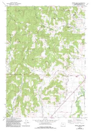
Muddy Valley Topo Map Oregon
To zoom in, hover over the map of Muddy Valley
USGS Topo Quad 45123b3 - 1:24,000 scale
| Topo Map Name: | Muddy Valley |
| USGS Topo Quad ID: | 45123b3 |
| Print Size: | ca. 21 1/4" wide x 27" high |
| Southeast Coordinates: | 45.125° N latitude / 123.25° W longitude |
| Map Center Coordinates: | 45.1875° N latitude / 123.3125° W longitude |
| U.S. State: | OR |
| Filename: | o45123b3.jpg |
| Download Map JPG Image: | Muddy Valley topo map 1:24,000 scale |
| Map Type: | Topographic |
| Topo Series: | 7.5´ |
| Map Scale: | 1:24,000 |
| Source of Map Images: | United States Geological Survey (USGS) |
| Alternate Map Versions: |
Muddy Valley OR 1979, updated 1979 Download PDF Buy paper map Muddy Valley OR 1979, updated 1992 Download PDF Buy paper map Muddy Valley OR 2011 Download PDF Buy paper map Muddy Valley OR 2014 Download PDF Buy paper map |
1:24,000 Topo Quads surrounding Muddy Valley
> Back to 45123a1 at 1:100,000 scale
> Back to 45122a1 at 1:250,000 scale
> Back to U.S. Topo Maps home
Muddy Valley topo map: Gazetteer
Muddy Valley: Dams
Peter Dinsdale Dam elevation 40m 131′Muddy Valley: Lakes
Haven Hill Pond elevation 302m 990′Muddy Valley: Parks
Charles Metsker County Park elevation 99m 324′Edward Grenfell County Park elevation 58m 190′
Erratic Rock State Park elevation 93m 305′
Huber County Park elevation 87m 285′
Juliette County Park elevation 172m 564′
Monroe Landing County Park elevation 39m 127′
Power House County Park elevation 102m 334′
Muddy Valley: Post Offices
Chase Post Office (historical) elevation 97m 318′Muddy Valley: Reservoirs
Blue Heron Reservoir elevation 40m 131′Mochettaz Reservoir elevation 136m 446′
Sander Reservoir elevation 262m 859′
Muddy Valley: Springs
Vierra Springs elevation 109m 357′Muddy Valley: Streams
Deer Creek elevation 37m 121′Devils Creek elevation 184m 603′
East Fork Muddy Creek elevation 64m 209′
Gill Creek elevation 159m 521′
Little Deer Creek elevation 174m 570′
Middle Fork Muddy Creek elevation 77m 252′
Muddy Creek elevation 44m 144′
Snake Creek elevation 76m 249′
Muddy Valley: Summits
Eagle Point elevation 321m 1053′Slide Mountain elevation 598m 1961′
The Butte elevation 429m 1407′
Muddy Valley: Valleys
Dupee Valley elevation 64m 209′Happy Valley elevation 52m 170′
Muddy Valley elevation 47m 154′
Muddy Valley digital topo map on disk
Buy this Muddy Valley topo map showing relief, roads, GPS coordinates and other geographical features, as a high-resolution digital map file on DVD:


