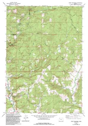
Stony Mountain Topo Map Oregon
To zoom in, hover over the map of Stony Mountain
USGS Topo Quad 45123b4 - 1:24,000 scale
| Topo Map Name: | Stony Mountain |
| USGS Topo Quad ID: | 45123b4 |
| Print Size: | ca. 21 1/4" wide x 27" high |
| Southeast Coordinates: | 45.125° N latitude / 123.375° W longitude |
| Map Center Coordinates: | 45.1875° N latitude / 123.4375° W longitude |
| U.S. State: | OR |
| Filename: | o45123b4.jpg |
| Download Map JPG Image: | Stony Mountain topo map 1:24,000 scale |
| Map Type: | Topographic |
| Topo Series: | 7.5´ |
| Map Scale: | 1:24,000 |
| Source of Map Images: | United States Geological Survey (USGS) |
| Alternate Map Versions: |
Stony Mountain OR 1979, updated 1992 Download PDF Buy paper map Stony Mountain OR 2011 Download PDF Buy paper map Stony Mountain OR 2014 Download PDF Buy paper map |
1:24,000 Topo Quads surrounding Stony Mountain
> Back to 45123a1 at 1:100,000 scale
> Back to 45122a1 at 1:250,000 scale
> Back to U.S. Topo Maps home
Stony Mountain topo map: Gazetteer
Stony Mountain: Parks
Blackwell County Park elevation 92m 301′Deer Creek County Park elevation 78m 255′
Stony Mountain: Post Offices
Gopher Post Office (historical) elevation 67m 219′Stony Mountain: Ridges
Stony Mountain elevation 709m 2326′Stony Mountain: Springs
La Toutena Mary Spring elevation 539m 1768′Stony Mountain: Streams
Baltimore Creek elevation 179m 587′Beaver Creek elevation 72m 236′
Cedar Creek elevation 447m 1466′
Coast Creek elevation 105m 344′
Cronin Creek elevation 78m 255′
East Creek elevation 113m 370′
Grohe Creek elevation 80m 262′
La Toutena Mary Creek elevation 152m 498′
Wiley Creek elevation 66m 216′
Stony Mountain: Summits
Green Top elevation 625m 2050′Stony Mountain: Valleys
Buck Hollow elevation 100m 328′Gopher Valley elevation 71m 232′
Stony Mountain digital topo map on disk
Buy this Stony Mountain topo map showing relief, roads, GPS coordinates and other geographical features, as a high-resolution digital map file on DVD:


