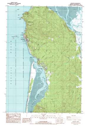
Netarts Topo Map Oregon
To zoom in, hover over the map of Netarts
USGS Topo Quad 45123d8 - 1:24,000 scale
| Topo Map Name: | Netarts |
| USGS Topo Quad ID: | 45123d8 |
| Print Size: | ca. 21 1/4" wide x 27" high |
| Southeast Coordinates: | 45.375° N latitude / 123.875° W longitude |
| Map Center Coordinates: | 45.4375° N latitude / 123.9375° W longitude |
| U.S. State: | OR |
| Filename: | o45123d8.jpg |
| Download Map JPG Image: | Netarts topo map 1:24,000 scale |
| Map Type: | Topographic |
| Topo Series: | 7.5´ |
| Map Scale: | 1:24,000 |
| Source of Map Images: | United States Geological Survey (USGS) |
| Alternate Map Versions: |
Netarts OR 1986, updated 1986 Download PDF Buy paper map Netarts OR 2011 Download PDF Buy paper map Netarts OR 2014 Download PDF Buy paper map |
| FStopo: | US Forest Service topo Netarts is available: Download FStopo PDF Download FStopo TIF |
1:24,000 Topo Quads surrounding Netarts
Nehalem |
Foley Peak |
Cook Creek |
||
Garibaldi |
Kilchis River |
Cedar Butte |
||
Netarts |
Tillamook |
The Peninsula |
||
Sand Lake |
Beaver |
Blaine |
||
Nestucca Bay |
Hebo |
Niagara Creek |
> Back to 45123a1 at 1:100,000 scale
> Back to 45122a1 at 1:250,000 scale
> Back to U.S. Topo Maps home
Netarts topo map: Gazetteer
Netarts: Areas
Silver Sands elevation 3m 9′Netarts: Bars
Netarts Spit elevation 11m 36′Netarts: Bays
McCoys Cove elevation 0m 0′Netarts Bay elevation 0m 0′
Netarts: Beaches
Agate Beach elevation 4m 13′Short Beach elevation 35m 114′
Wilson Beach elevation 14m 45′
Netarts: Capes
Boulder Point elevation 0m 0′Cape Meares elevation 98m 321′
Dick Point elevation 0m 0′
Maxwell Point elevation 40m 131′
Memaloose Point elevation 2m 6′
Rock Point elevation 0m 0′
Netarts: Islands
Delta Island elevation 1m 3′Dry Stocking Island elevation 2m 6′
Pillar Rock elevation 6m 19′
Pyramid Rock elevation 0m 0′
Sand Island elevation 1m 3′
Seal Rock elevation 0m 0′
Snag Island elevation 2m 6′
Three Arch Rocks elevation 54m 177′
Netarts: Levees
Dick Point Dike elevation 0m 0′Netarts: Parks
Cape Meares National Wildlife Refuge elevation 212m 695′Cape Meares State Park elevation 106m 347′
Happy Camp County Park elevation 5m 16′
Netarts Community County Park elevation 16m 52′
Oceanside Beach State Recreation Site elevation 3m 9′
Symons State Park elevation 7m 22′
Three Arch Rocks National Wildlife Refuge elevation 0m 0′
Netarts: Pillars
Flower Pot (historical) elevation 3m 9′Netarts: Populated Places
Cape Meares elevation 75m 246′Netarts elevation 21m 68′
Oceanside elevation 45m 147′
Netarts: Post Offices
Cape Meares Post Office (historical) elevation 75m 246′Netarts Post Office elevation 21m 68′
Oceanside Post Office elevation 45m 147′
Netarts: Streams
Austin Creek elevation 4m 13′Baughman Creek elevation 0m 0′
Esther Creek elevation 2m 6′
Fagan Creek elevation 13m 42′
Fall Creek elevation 21m 68′
Flower Pot Creek elevation 1m 3′
Hodgdon Creek elevation 0m 0′
Larson Creek elevation 6m 19′
Memaloose Creek elevation 0m 0′
North Branch Fall Creek elevation 54m 177′
O'Hara Creek elevation 5m 16′
Rice Creek elevation 4m 13′
Short Creek elevation 6m 19′
Tillamook River elevation 0m 0′
Tomlinson Creek elevation 2m 6′
Tomlinson Slough elevation 2m 6′
Trask River elevation 1m 3′
Whiskey Creek elevation 4m 13′
Wilson River elevation 0m 0′
Yager Creek elevation 2m 6′
Netarts digital topo map on disk
Buy this Netarts topo map showing relief, roads, GPS coordinates and other geographical features, as a high-resolution digital map file on DVD:


