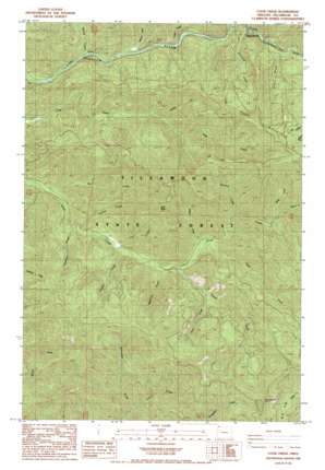
Cook Creek Topo Map Oregon
To zoom in, hover over the map of Cook Creek
USGS Topo Quad 45123f6 - 1:24,000 scale
| Topo Map Name: | Cook Creek |
| USGS Topo Quad ID: | 45123f6 |
| Print Size: | ca. 21 1/4" wide x 27" high |
| Southeast Coordinates: | 45.625° N latitude / 123.625° W longitude |
| Map Center Coordinates: | 45.6875° N latitude / 123.6875° W longitude |
| U.S. State: | OR |
| Filename: | o45123f6.jpg |
| Download Map JPG Image: | Cook Creek topo map 1:24,000 scale |
| Map Type: | Topographic |
| Topo Series: | 7.5´ |
| Map Scale: | 1:24,000 |
| Source of Map Images: | United States Geological Survey (USGS) |
| Alternate Map Versions: |
Cook Creek OR 1984, updated 1984 Download PDF Buy paper map Cook Creek OR 1984, updated 1984 Download PDF Buy paper map Cook Creek OR 2011 Download PDF Buy paper map Cook Creek OR 2014 Download PDF Buy paper map |
1:24,000 Topo Quads surrounding Cook Creek
> Back to 45123e1 at 1:100,000 scale
> Back to 45122a1 at 1:250,000 scale
> Back to U.S. Topo Maps home
Cook Creek topo map: Gazetteer
Cook Creek: Post Offices
Helloff Post Office (historical) elevation 94m 308′Rector Post Office (historical) elevation 45m 147′
Salmonberry Post Office (historical) elevation 133m 436′
Cook Creek: Streams
Bastard Creek elevation 45m 147′Clammer Creek elevation 89m 291′
Dry Creek elevation 25m 82′
East Fork Cook Creek elevation 147m 482′
French Creek elevation 227m 744′
Granite Creek elevation 192m 629′
Hanson Creek elevation 88m 288′
Harliss Creek elevation 74m 242′
Hatchery Creek elevation 74m 242′
Helloff Creek elevation 34m 111′
Hoevet Creek elevation 257m 843′
McKenny Creek elevation 110m 360′
Sibley Creek elevation 209m 685′
Snark Creek elevation 46m 150′
South Fork Cook Creek elevation 127m 416′
Starr Creek elevation 245m 803′
Strahm Creek elevation 135m 442′
Cook Creek: Summits
High Butte elevation 639m 2096′Triangulation Point elevation 987m 3238′
Cook Creek: Valleys
Bulck Canyon elevation 88m 288′Platt Canyon elevation 138m 452′
Cook Creek digital topo map on disk
Buy this Cook Creek topo map showing relief, roads, GPS coordinates and other geographical features, as a high-resolution digital map file on DVD:


