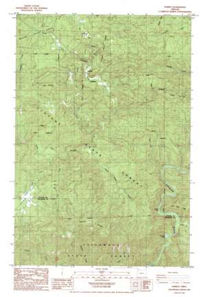
Hamlet Topo Map Oregon
To zoom in, hover over the map of Hamlet
USGS Topo Quad 45123g6 - 1:24,000 scale
| Topo Map Name: | Hamlet |
| USGS Topo Quad ID: | 45123g6 |
| Print Size: | ca. 21 1/4" wide x 27" high |
| Southeast Coordinates: | 45.75° N latitude / 123.625° W longitude |
| Map Center Coordinates: | 45.8125° N latitude / 123.6875° W longitude |
| U.S. State: | OR |
| Filename: | o45123g6.jpg |
| Download Map JPG Image: | Hamlet topo map 1:24,000 scale |
| Map Type: | Topographic |
| Topo Series: | 7.5´ |
| Map Scale: | 1:24,000 |
| Source of Map Images: | United States Geological Survey (USGS) |
| Alternate Map Versions: |
Hamlet OR 1984, updated 1984 Download PDF Buy paper map Hamlet OR 1984, updated 1984 Download PDF Buy paper map Hamlet OR 2011 Download PDF Buy paper map Hamlet OR 2014 Download PDF Buy paper map |
1:24,000 Topo Quads surrounding Hamlet
> Back to 45123e1 at 1:100,000 scale
> Back to 45122a1 at 1:250,000 scale
> Back to U.S. Topo Maps home
Hamlet topo map: Gazetteer
Hamlet: Bridges
Yunkers High Bridge elevation 92m 301′Hamlet: Falls
North Fork Falls elevation 97m 318′Hamlet: Populated Places
Hamlet elevation 170m 557′Hamlet: Post Offices
Hamlet Post Office (historical) elevation 170m 557′Owens Post Office (historical) elevation 123m 403′
Hamlet: Rapids
Beaver Eddy elevation 95m 311′Morrison Eddy elevation 70m 229′
Hamlet: Ridges
Rector Ridge elevation 643m 2109′Hamlet: Streams
Cronin Creek elevation 76m 249′Fall Creek elevation 126m 413′
Gods Valley Creek elevation 98m 321′
Little North Fork Nehalem River elevation 170m 557′
Lost Creek elevation 106m 347′
Rector Creek elevation 121m 396′
Salmonberry River elevation 83m 272′
Sweet Home Creek elevation 113m 370′
Hamlet: Summits
Cole Mountain elevation 396m 1299′Cougar Mountain elevation 529m 1735′
Hamlet: Valleys
Gods Valley elevation 107m 351′Hamlet digital topo map on disk
Buy this Hamlet topo map showing relief, roads, GPS coordinates and other geographical features, as a high-resolution digital map file on DVD:


