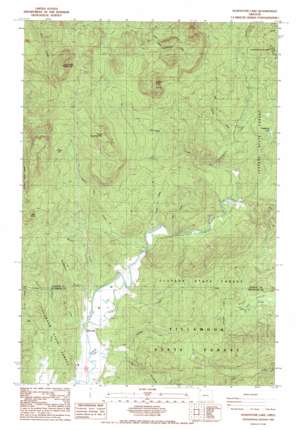
Soapstone Lake Topo Map Oregon
To zoom in, hover over the map of Soapstone Lake
USGS Topo Quad 45123g7 - 1:24,000 scale
| Topo Map Name: | Soapstone Lake |
| USGS Topo Quad ID: | 45123g7 |
| Print Size: | ca. 21 1/4" wide x 27" high |
| Southeast Coordinates: | 45.75° N latitude / 123.75° W longitude |
| Map Center Coordinates: | 45.8125° N latitude / 123.8125° W longitude |
| U.S. State: | OR |
| Filename: | o45123g7.jpg |
| Download Map JPG Image: | Soapstone Lake topo map 1:24,000 scale |
| Map Type: | Topographic |
| Topo Series: | 7.5´ |
| Map Scale: | 1:24,000 |
| Source of Map Images: | United States Geological Survey (USGS) |
| Alternate Map Versions: |
Soapstone Lake OR 1985, updated 1985 Download PDF Buy paper map Soapstone Lake OR 2011 Download PDF Buy paper map Soapstone Lake OR 2014 Download PDF Buy paper map |
1:24,000 Topo Quads surrounding Soapstone Lake
> Back to 45123e1 at 1:100,000 scale
> Back to 45122a1 at 1:250,000 scale
> Back to U.S. Topo Maps home
Soapstone Lake topo map: Gazetteer
Soapstone Lake: Lakes
Grassy Lake elevation 366m 1200′Soapstone Lake: Parks
North Fork Nehalem County Park elevation 53m 173′Soapstone Lake: Populated Places
Aldervale elevation 3m 9′Soapstone Lake: Post Offices
Barbra Post Office (historical) elevation 48m 157′Eden Post Office (historical) elevation 208m 682′
Onion Peak Post Office (historical) elevation 7m 22′
Soapstone Lake: Reservoirs
Soapstone Lake elevation 162m 531′Soapstone Lake: Streams
Acey Creek elevation 7m 22′Big Rackheap Creek elevation 7m 22′
Boykin Creek elevation 3m 9′
Buchanan Creek elevation 49m 160′
Cougar Creek elevation 20m 65′
Fall Creek elevation 9m 29′
Grassy Lake Creek elevation 26m 85′
Henderson Creek elevation 7m 22′
Jack Horner Creek elevation 80m 262′
Little Rackheap Creek elevation 4m 13′
Rackheap Creek elevation 3m 9′
Soapstone Creek elevation 71m 232′
Trail Creek elevation 21m 68′
West Fork Coal Creek elevation 14m 45′
Soapstone Lake: Summits
Black Butte elevation 603m 1978′Kidders Butte elevation 643m 2109′
South Sugarloaf elevation 605m 1984′
Sugarloaf Mountain elevation 787m 2582′
Soapstone Lake digital topo map on disk
Buy this Soapstone Lake topo map showing relief, roads, GPS coordinates and other geographical features, as a high-resolution digital map file on DVD:


