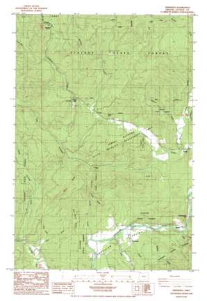
Vinemaple Topo Map Oregon
To zoom in, hover over the map of Vinemaple
USGS Topo Quad 45123h5 - 1:24,000 scale
| Topo Map Name: | Vinemaple |
| USGS Topo Quad ID: | 45123h5 |
| Print Size: | ca. 21 1/4" wide x 27" high |
| Southeast Coordinates: | 45.875° N latitude / 123.5° W longitude |
| Map Center Coordinates: | 45.9375° N latitude / 123.5625° W longitude |
| U.S. State: | OR |
| Filename: | o45123h5.jpg |
| Download Map JPG Image: | Vinemaple topo map 1:24,000 scale |
| Map Type: | Topographic |
| Topo Series: | 7.5´ |
| Map Scale: | 1:24,000 |
| Source of Map Images: | United States Geological Survey (USGS) |
| Alternate Map Versions: |
Vinemaple OR 1984, updated 1984 Download PDF Buy paper map Vinemaple OR 1984, updated 1984 Download PDF Buy paper map Vinemaple OR 2011 Download PDF Buy paper map Vinemaple OR 2014 Download PDF Buy paper map |
1:24,000 Topo Quads surrounding Vinemaple
> Back to 45123e1 at 1:100,000 scale
> Back to 45122a1 at 1:250,000 scale
> Back to U.S. Topo Maps home
Vinemaple topo map: Gazetteer
Vinemaple: Bridges
Vinemaple Bridge elevation 129m 423′Vinemaple: Capes
Denver Point elevation 236m 774′Vinemaple: Falls
Fishhawk Falls elevation 246m 807′Vinemaple: Gaps
Tidewater Summit elevation 385m 1263′Vinemaple: Parks
Fishhawk Falls - Lee Wooden County Park elevation 246m 807′Jewell Meadows State Wildlife Management Area elevation 233m 764′
Sunset Highway State Park elevation 157m 515′
Vinemaple: Populated Places
Denver (historical) elevation 201m 659′Grand Rapids elevation 140m 459′
Jewell elevation 143m 469′
Vinemaple elevation 139m 456′
Vinemaple: Post Offices
Denver Post Office (historical) elevation 201m 659′Grand Rapids Post Office (historical) elevation 140m 459′
Jewell Post Office (historical) elevation 143m 469′
Medley Post Office (historical) elevation 187m 613′
Vinemaple Post Office (historical) elevation 139m 456′
Vinemaple: Ridges
Boiler Ridge elevation 450m 1476′Pope Ridge elevation 308m 1010′
Red Bluff Ridge elevation 284m 931′
Vinemaple: Streams
Alder Creek elevation 144m 472′Alder Creek elevation 171m 561′
Bull Heifer Creek elevation 276m 905′
Buster Creek elevation 131m 429′
Cedar Creek elevation 159m 521′
Cow Creek elevation 129m 423′
East Humbug Creek elevation 157m 515′
Fishhawk Creek elevation 143m 469′
Furtado Creek elevation 135m 442′
George Creek elevation 127m 416′
Gilmore Creek elevation 154m 505′
Hamilton Creek elevation 196m 643′
Josie Creek elevation 147m 482′
Klines Creek elevation 127m 416′
Little Fishhawk Creek elevation 155m 508′
Moores Creek elevation 128m 419′
West Humbug Creek elevation 159m 521′
Vinemaple digital topo map on disk
Buy this Vinemaple topo map showing relief, roads, GPS coordinates and other geographical features, as a high-resolution digital map file on DVD:


