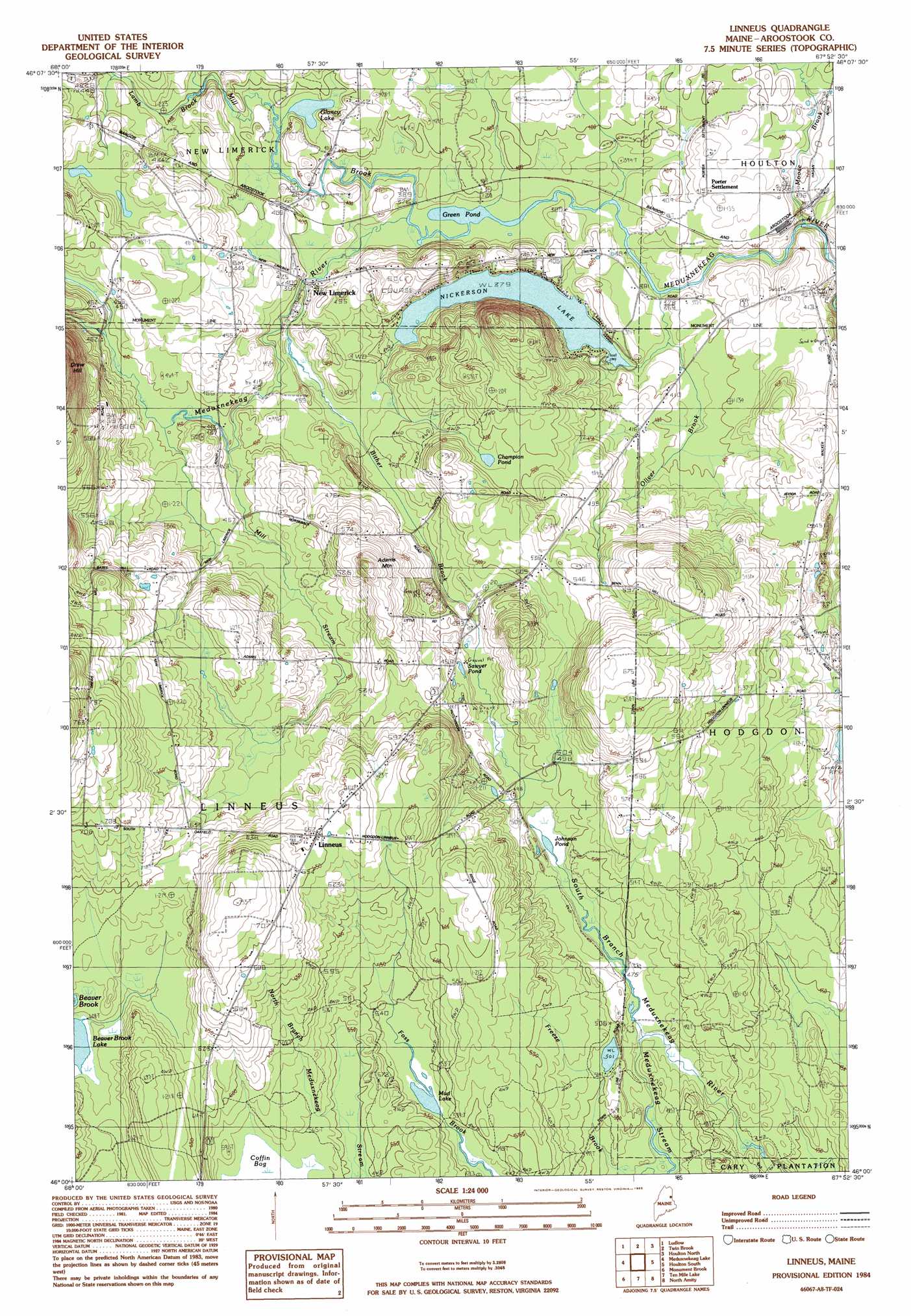
Linneus Topo Map Maine
To zoom in, hover over the map of Linneus
USGS Topo Quad 46067a8 - 1:24,000 scale
| Topo Map Name: | Linneus |
| USGS Topo Quad ID: | 46067a8 |
| Print Size: | ca. 21 1/4" wide x 27" high |
| Southeast Coordinates: | 46° N latitude / 67.875° W longitude |
| Map Center Coordinates: | 46.0625° N latitude / 67.9375° W longitude |
| U.S. State: | ME |
| Filename: | o46067a8.jpg |
| Download Map JPG Image: | Linneus topo map 1:24,000 scale |
| Map Type: | Topographic |
| Topo Series: | 7.5´ |
| Map Scale: | 1:24,000 |
| Source of Map Images: | United States Geological Survey (USGS) |
| Alternate Map Versions: |
Houlton SW ME 1975, updated 1980 Download PDF Buy paper map Linneus ME 1984, updated 1985 Download PDF Buy paper map Linneus ME 2011 Download PDF Buy paper map Linneus ME 2014 Download PDF Buy paper map |
1:24,000 Topo Quads surrounding Linneus
Saint Croix Lake |
North Brook Ridge |
Harvey |
Monticello |
|
Smyrna Mills |
Ludlow |
Twin Brook |
Houlton North |
|
Oakfield |
Meduxnekeag Lake |
Linneus |
Houlton South |
|
Mattawamkeag Lake |
Monument Brook |
Ten Mile Lake |
North Amity |
|
Wytopitlock Lake |
Alder Brook |
Haynesville |
Orient |
> Back to 46067a1 at 1:100,000 scale
> Back to 46066a1 at 1:250,000 scale
> Back to U.S. Topo Maps home
Linneus topo map: Gazetteer
Linneus: Lakes
Champion Pond elevation 148m 485′Glancy Lake elevation 118m 387′
Green Pond elevation 114m 374′
Hunter Pond elevation 153m 501′
Johnson Pond elevation 145m 475′
Mud Lake elevation 163m 534′
Nickerson Lake elevation 115m 377′
Sawyer Pond elevation 149m 488′
Linneus: Populated Places
Linneus elevation 197m 646′New Limerick elevation 119m 390′
Linneus: Streams
Freeze Brook elevation 145m 475′Meduxnekeag Stream elevation 143m 469′
Mill Brook elevation 114m 374′
Mill Stream elevation 132m 433′
Moose Brook elevation 113m 370′
Linneus: Summits
Adams elevation 205m 672′Linneus digital topo map on disk
Buy this Linneus topo map showing relief, roads, GPS coordinates and other geographical features, as a high-resolution digital map file on DVD:
Maine, New Hampshire, Rhode Island & Eastern Massachusetts
Buy digital topo maps: Maine, New Hampshire, Rhode Island & Eastern Massachusetts