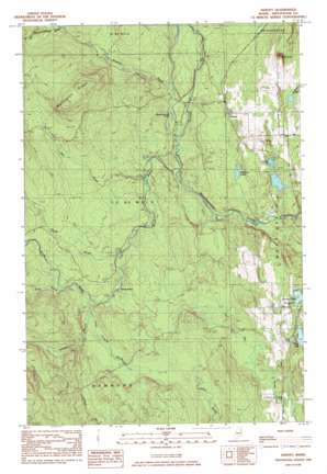
Harvey Topo Map Maine
To zoom in, hover over the map of Harvey
USGS Topo Quad 46067c8 - 1:24,000 scale
| Topo Map Name: | Harvey |
| USGS Topo Quad ID: | 46067c8 |
| Print Size: | ca. 21 1/4" wide x 27" high |
| Southeast Coordinates: | 46.25° N latitude / 67.875° W longitude |
| Map Center Coordinates: | 46.3125° N latitude / 67.9375° W longitude |
| U.S. State: | ME |
| Filename: | o46067c8.jpg |
| Download Map JPG Image: | Harvey topo map 1:24,000 scale |
| Map Type: | Topographic |
| Topo Series: | 7.5´ |
| Map Scale: | 1:24,000 |
| Source of Map Images: | United States Geological Survey (USGS) |
| Alternate Map Versions: |
Bridgewater SW ME 1975, updated 1981 Download PDF Buy paper map Harvey ME 1984, updated 1984 Download PDF Buy paper map Harvey ME 2011 Download PDF Buy paper map Harvey ME 2014 Download PDF Buy paper map |
1:24,000 Topo Quads surrounding Harvey
> Back to 46067a1 at 1:100,000 scale
> Back to 46066a1 at 1:250,000 scale
> Back to U.S. Topo Maps home
Harvey topo map: Gazetteer
Harvey: Lakes
Alerton Lake elevation 141m 462′Conroy Lake elevation 140m 459′
Culling Pond elevation 143m 469′
Deep Lake elevation 145m 475′
Meadowbrook Pond elevation 145m 475′
Ross Lake elevation 146m 479′
Harvey: Populated Places
Harvey elevation 164m 538′Morey Brow elevation 157m 515′
Harvey: Ridges
Wellington Ridge elevation 283m 928′Harvey: Streams
Bell Brook elevation 145m 475′Bog Brook elevation 183m 600′
Gould Brook elevation 152m 498′
Hill Brook elevation 193m 633′
Howard Brook elevation 161m 528′
Little Howard Brook elevation 163m 534′
Meadow Brook elevation 140m 459′
Parks Brook elevation 170m 557′
South Brook elevation 136m 446′
Harvey: Summits
Sugar Loaf elevation 241m 790′Harvey digital topo map on disk
Buy this Harvey topo map showing relief, roads, GPS coordinates and other geographical features, as a high-resolution digital map file on DVD:
Maine, New Hampshire, Rhode Island & Eastern Massachusetts
Buy digital topo maps: Maine, New Hampshire, Rhode Island & Eastern Massachusetts


