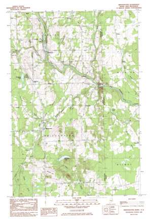
Bridgewater Topo Map Maine
To zoom in, hover over the map of Bridgewater
USGS Topo Quad 46067d7 - 1:24,000 scale
| Topo Map Name: | Bridgewater |
| USGS Topo Quad ID: | 46067d7 |
| Print Size: | ca. 21 1/4" wide x 27" high |
| Southeast Coordinates: | 46.375° N latitude / 67.75° W longitude |
| Map Center Coordinates: | 46.4375° N latitude / 67.8125° W longitude |
| U.S. State: | ME |
| Filename: | o46067d7.jpg |
| Download Map JPG Image: | Bridgewater topo map 1:24,000 scale |
| Map Type: | Topographic |
| Topo Series: | 7.5´ |
| Map Scale: | 1:24,000 |
| Source of Map Images: | United States Geological Survey (USGS) |
| Alternate Map Versions: |
Bridgewater NE ME 1975, updated 1981 Download PDF Buy paper map Bridgewater ME 1984, updated 1985 Download PDF Buy paper map Bridgewater ME 2011 Download PDF Buy paper map Bridgewater ME 2014 Download PDF Buy paper map |
1:24,000 Topo Quads surrounding Bridgewater
Presque Isle |
Easton |
Easton Center |
||
Echo Lake |
Westfield |
Mars Hill |
||
Number Nine Lake |
Packard Lake |
Bridgewater |
||
North Brook Ridge |
Harvey |
Monticello |
||
Ludlow |
Twin Brook |
Houlton North |
> Back to 46067a1 at 1:100,000 scale
> Back to 46066a1 at 1:250,000 scale
> Back to U.S. Topo Maps home
Bridgewater topo map: Gazetteer
Bridgewater: Dams
Robinson Dam elevation 112m 367′Bridgewater: Lakes
Portland Lake elevation 135m 442′Whitehead Lake elevation 145m 475′
Bridgewater: Populated Places
Bridgewater elevation 130m 426′Bridgewater Corner elevation 160m 524′
Robinson elevation 112m 367′
Snow Settlement elevation 188m 616′
Sugar Hill elevation 134m 439′
Bridgewater: Reservoirs
Prestile Stream elevation 112m 367′Bridgewater: Streams
Dead Brook elevation 122m 400′Gin Brook elevation 111m 364′
North Branch Three Brooks elevation 131m 429′
North Branch Whitney Brook elevation 124m 406′
Russell Brook elevation 139m 456′
South Branch Three Brooks elevation 129m 423′
South Branch Whitney Brook elevation 124m 406′
Three Brooks elevation 108m 354′
Whitney Brook elevation 107m 351′
Young Brook elevation 98m 321′
Bridgewater: Summits
Bunker Hill elevation 199m 652′Bridgewater digital topo map on disk
Buy this Bridgewater topo map showing relief, roads, GPS coordinates and other geographical features, as a high-resolution digital map file on DVD:
Maine, New Hampshire, Rhode Island & Eastern Massachusetts
Buy digital topo maps: Maine, New Hampshire, Rhode Island & Eastern Massachusetts


