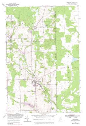
Limestone Topo Map Maine
To zoom in, hover over the map of Limestone
USGS Topo Quad 46067h7 - 1:24,000 scale
| Topo Map Name: | Limestone |
| USGS Topo Quad ID: | 46067h7 |
| Print Size: | ca. 21 1/4" wide x 27" high |
| Southeast Coordinates: | 46.875° N latitude / 67.75° W longitude |
| Map Center Coordinates: | 46.9375° N latitude / 67.8125° W longitude |
| U.S. State: | ME |
| Filename: | o46067h7.jpg |
| Download Map JPG Image: | Limestone topo map 1:24,000 scale |
| Map Type: | Topographic |
| Topo Series: | 7.5´ |
| Map Scale: | 1:24,000 |
| Source of Map Images: | United States Geological Survey (USGS) |
| Alternate Map Versions: |
Limestone ME 1953, updated 1955 Download PDF Buy paper map Limestone ME 1953, updated 1978 Download PDF Buy paper map Limestone ME 1975, updated 1981 Download PDF Buy paper map Limestone ME 2011 Download PDF Buy paper map Limestone ME 2014 Download PDF Buy paper map |
1:24,000 Topo Quads surrounding Limestone
Violette Stream |
Van Buren |
|||
Picard Brook |
Doyle Ridge |
Hamlin |
||
New Sweden |
Fort Fairfield Nw |
Limestone |
||
Caribou |
Goodwin |
Fort Fairfield |
||
Presque Isle |
Easton |
Easton Center |
> Back to 46067e1 at 1:100,000 scale
> Back to 46066a1 at 1:250,000 scale
> Back to U.S. Topo Maps home
Limestone topo map: Gazetteer
Limestone: Dams
Butterfield Brook Dam elevation 197m 646′Durepo Brook Dam elevation 189m 620′
Limestone Community Dam elevation 159m 521′
Noyes Brook Dam elevation 181m 593′
Webster Brook Dam elevation 176m 577′
Limestone: Lakes
Pierce Lake elevation 213m 698′Limestone: Populated Places
Cote Corner elevation 208m 682′Four Corners elevation 164m 538′
Grass Corner elevation 219m 718′
Limestone elevation 181m 593′
Morris Corner elevation 203m 666′
Limestone: Reservoirs
Butterfield Brook Pond elevation 197m 646′Durepo Pond elevation 189m 620′
Layton Lake elevation 201m 659′
Layton Pond elevation 201m 659′
Limestone Pond elevation 159m 521′
Noyes Pond elevation 181m 593′
Limestone: Streams
Butterfield Brook elevation 188m 616′Daggett Brook elevation 213m 698′
Durepo Brook elevation 188m 616′
Silver Spring Brook elevation 162m 531′
Willard Brook elevation 197m 646′
Limestone: Summits
Kennison Hill elevation 211m 692′Limestone digital topo map on disk
Buy this Limestone topo map showing relief, roads, GPS coordinates and other geographical features, as a high-resolution digital map file on DVD:
Maine, New Hampshire, Rhode Island & Eastern Massachusetts
Buy digital topo maps: Maine, New Hampshire, Rhode Island & Eastern Massachusetts


