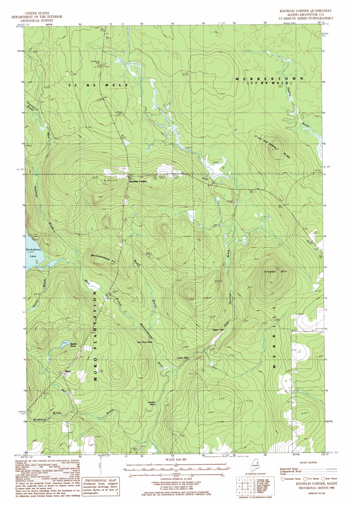
Knowles Corner Topo Map Maine
To zoom in, hover over the map of Knowles Corner
USGS Topo Quad 46068b3 - 1:24,000 scale
| Topo Map Name: | Knowles Corner |
| USGS Topo Quad ID: | 46068b3 |
| Print Size: | ca. 21 1/4" wide x 27" high |
| Southeast Coordinates: | 46.125° N latitude / 68.25° W longitude |
| Map Center Coordinates: | 46.1875° N latitude / 68.3125° W longitude |
| U.S. State: | ME |
| Filename: | o46068b3.jpg |
| Download Map JPG Image: | Knowles Corner topo map 1:24,000 scale |
| Map Type: | Topographic |
| Topo Series: | 7.5´ |
| Map Scale: | 1:24,000 |
| Source of Map Images: | United States Geological Survey (USGS) |
| Alternate Map Versions: |
Knowles Corner ME 1986, updated 1986 Download PDF Buy paper map Knowles Corner ME 2011 Download PDF Buy paper map Knowles Corner ME 2014 Download PDF Buy paper map |
1:24,000 Topo Quads surrounding Knowles Corner
Oxbow West |
Oxbow East |
Griswold |
Spinney Brook |
Number Nine Lake |
La Pomkeag Lake |
Umcolcus Lake |
Mcnally Ridge |
Saint Croix Lake |
North Brook Ridge |
Hay Brook Mountain |
Green Mountain |
Knowles Corner |
Smyrna Mills |
Ludlow |
Shin Pond |
Mount Chase |
Island Falls |
Oakfield |
Meduxnekeag Lake |
Lookout Mountain |
Patten |
Crystal |
Mattawamkeag Lake |
Monument Brook |
> Back to 46068a1 at 1:100,000 scale
> Back to 46068a1 at 1:250,000 scale
> Back to U.S. Topo Maps home
Knowles Corner topo map: Gazetteer
Knowles Corner: Canals
Jackson Sluice elevation 184m 603′Knowles Corner: Dams
Rockabema Outlet Dam elevation 203m 666′Knowles Corner: Falls
Lower Falls elevation 184m 603′Upper Falls elevation 223m 731′
Knowles Corner: Lakes
Rockabema Lake elevation 203m 666′Secret Pond elevation 252m 826′
Knowles Corner: Populated Places
Batesville elevation 247m 810′Knowles Corner elevation 344m 1128′
Moro elevation 254m 833′
Knowles Corner: Ridges
Frost and Adams Ridge elevation 345m 1131′Knowles Corner: Streams
Atwell Brook elevation 204m 669′Baston Brook elevation 187m 613′
Bradford Brook elevation 225m 738′
East Hastings Brook elevation 180m 590′
Mill Brook elevation 171m 561′
Townline Brook elevation 240m 787′
West Hastings Brook elevation 205m 672′
Knowles Corner: Summits
Mattawamkeag Hill elevation 239m 784′Sholler Mountain elevation 403m 1322′
Knowles Corner digital topo map on disk
Buy this Knowles Corner topo map showing relief, roads, GPS coordinates and other geographical features, as a high-resolution digital map file on DVD:
Maine, New Hampshire, Rhode Island & Eastern Massachusetts
Buy digital topo maps: Maine, New Hampshire, Rhode Island & Eastern Massachusetts